TRY THIS MODEL
Drop image here to test
tree-detection-ntf74/6 (latest)
The training set is empty.
The validation set is empty.
The testing set is empty.
Classes
Layers
{
"accumulator": null,
"annotation_jobs": [
"8Fu4BtpSZNfqPefyaNQh/09Ht0kqXq65p3LHkENUX",
"dTeLVe9vEcJB0QKJjjsG/ArDgqhjaHL3Zw0MEL0ao",
"FNC1oLpw7yLLJ00srapF/BjiKwCgMdaN3VqYymZFQ"
],
"annotations": {
"trees": {
"original": {
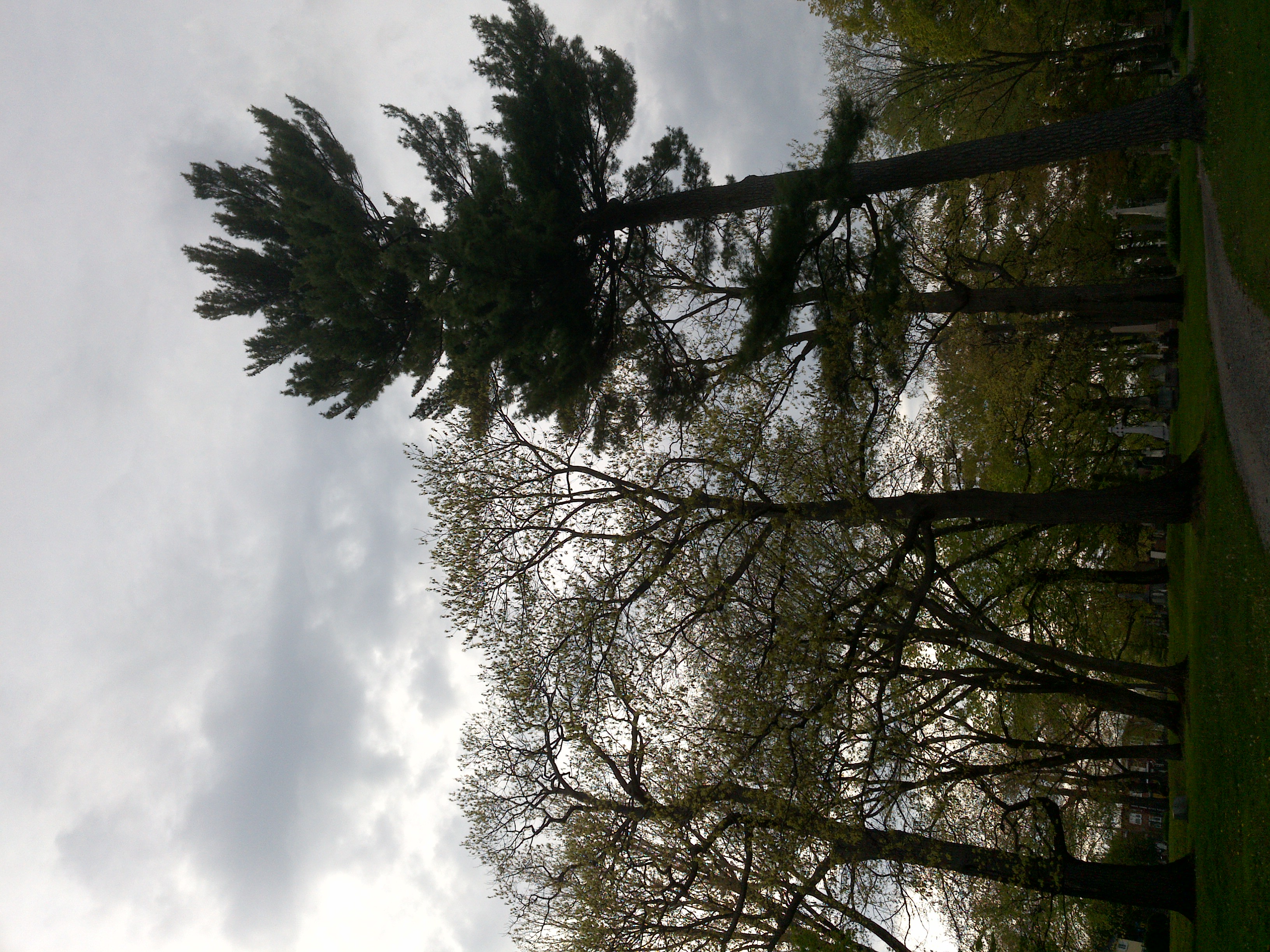
"annotation": "[{\"id\":27,\"image_id\":11,\"category_id\":31,\"segmentation\":[],\"bbox\":[236.48659793814437,264.54432989690724,941.9381443298969,1551.1917525773197],\"ignore\":0,\"iscrowd\":0,\"area\":1461126.680922521},{\"id\":28,\"image_id\":11,\"category_id\":31,\"segmentation\":[],\"bbox\":[2147.084536082474,641.319587628866,444.91546391752576,1118.3010309278352],\"ignore\":0,\"iscrowd\":0,\"area\":497549.4219747051},{\"id\":29,\"image_id\":11,\"category_id\":31,\"segmentation\":[],\"bbox\":[1110.2845360824742,96.1979381443299,1398.878350515464,1787.678350515464],\"ignore\":0,\"iscrowd\":0,\"area\":2500744.542221278}]",
"format": "json",
"source": "coco"
},
"converted": "{\"key\":\"7bc021e1-200622_173511_Garmin_Oregon7xx_DSC00027.jpg\",\"boxes\":[{\"label\":\"Tree\",\"x\":707.4556701030929,\"y\":1040.140206185567,\"width\":941.9381443298969,\"height\":1551.1917525773197,\"keypoints\":[]},{\"label\":\"Tree\",\"x\":2369.542268041237,\"y\":1200.4701030927836,\"width\":444.91546391752576,\"height\":1118.3010309278352,\"keypoints\":[]},{\"label\":\"Tree\",\"x\":1809.7237113402061,\"y\":990.0371134020619,\"width\":1398.878350515464,\"height\":1787.678350515464,\"keypoints\":[]}],\"width\":2592,\"height\":1944}",
"extra": null,
"used": true,
"key": [
"7bc021e1-200622_173511_Garmin_Oregon7xx_DSC00027.jpg"
]
},
"trees-qDft": {
"original": {
"annotation": "[{\"id\":27,\"image_id\":11,\"category_id\":31,\"segmentation\":[],\"bbox\":[236.48659793814437,264.54432989690724,941.9381443298969,1551.1917525773197],\"ignore\":0,\"iscrowd\":0,\"area\":1461126.680922521},{\"id\":28,\"image_id\":11,\"category_id\":31,\"segmentation\":[],\"bbox\":[2147.084536082474,641.319587628866,444.91546391752576,1118.3010309278352],\"ignore\":0,\"iscrowd\":0,\"area\":497549.4219747051},{\"id\":29,\"image_id\":11,\"category_id\":31,\"segmentation\":[],\"bbox\":[1110.2845360824742,96.1979381443299,1398.878350515464,1787.678350515464],\"ignore\":0,\"iscrowd\":0,\"area\":2500744.542221278}]",
"format": "json",
"source": "coco"
},
"extra": null,
"used": true,
"key": [
"7bc021e1-200622_173511_Garmin_Oregon7xx_DSC00027.jpg"
],
"by": "vKApOnDiwjaSVG3dsP3mDQx4C3g2",
"converted": "{\"key\":\"7bc021e1-200622_173511_Garmin_Oregon7xx_DSC00027.jpg\",\"boxes\":[{\"label\":\"Feuillu\",\"x\":\"707.46\",\"y\":\"1040.14\",\"width\":\"941.94\",\"height\":\"1551.19\"},{\"label\":\"Feuillu\",\"x\":\"2368.68\",\"y\":\"1200.47\",\"width\":\"444.92\",\"height\":\"1118.30\"},{\"label\":\"Feuillu\",\"x\":\"1809.72\",\"y\":\"990.82\",\"width\":\"1398.88\",\"height\":\"1787.68\"}],\"width\":2592,\"height\":1944}",
"lastSet": "1705421769529"
},
"Tree": {
"original": {
"annotation": "[{\"id\":27,\"image_id\":11,\"category_id\":31,\"segmentation\":[],\"bbox\":[236.48659793814437,264.54432989690724,941.9381443298969,1551.1917525773197],\"ignore\":0,\"iscrowd\":0,\"area\":1461126.680922521},{\"id\":28,\"image_id\":11,\"category_id\":31,\"segmentation\":[],\"bbox\":[2147.084536082474,641.319587628866,444.91546391752576,1118.3010309278352],\"ignore\":0,\"iscrowd\":0,\"area\":497549.4219747051},{\"id\":29,\"image_id\":11,\"category_id\":31,\"segmentation\":[],\"bbox\":[1110.2845360824742,96.1979381443299,1398.878350515464,1787.678350515464],\"ignore\":0,\"iscrowd\":0,\"area\":2500744.542221278}]",
"format": "json",
"source": "coco"
},
"converted": "{\"key\":\"7bc021e1-200622_173511_Garmin_Oregon7xx_DSC00027.jpg\",\"boxes\":[{\"label\":\"Tree\",\"x\":707.4556701030929,\"y\":1040.140206185567,\"width\":941.9381443298969,\"height\":1551.1917525773197,\"keypoints\":[]},{\"label\":\"Tree\",\"x\":2369.542268041237,\"y\":1200.4701030927836,\"width\":444.91546391752576,\"height\":1118.3010309278352,\"keypoints\":[]},{\"label\":\"Tree\",\"x\":1809.7237113402061,\"y\":990.0371134020619,\"width\":1398.878350515464,\"height\":1787.678350515464,\"keypoints\":[]}],\"width\":2592,\"height\":1944}",
"extra": null,
"used": true,
"key": [
"7bc021e1-200622_173511_Garmin_Oregon7xx_DSC00027.jpg"
]
}
},
"camera": "Garmin Oregon 7xx",
"classes": [
"trees",
"trees-qDft",
"Tree"
],
"created": {
"_seconds": 1705367192,
"_nanoseconds": 893000000
},
"datasets": [
"8Fu4BtpSZNfqPefyaNQh",
"dTeLVe9vEcJB0QKJjjsG",
"FNC1oLpw7yLLJ00srapF"
],
"extension": "jpg",
"hashes": [
"485f1ea9931c7684d476a5ac15b72027"
],
"height": 1944,
"id": "uSIvd4V23e43sMHj9EZ9",
"label": [
"Unlabeled"
],
"metadata": {
"ExifVersion": "0220",
"GPSLatitude": "46,48,25.035627770786014",
"GPSAltitude": "26.041961954144043",
"GPSAltitudeRef": "0",
"DateTime": "2020:06:22 17:35:11",
"GPSMapDatum": "WGS-84",
"DateTimeOriginal": "2020:06:22 17:35:11",
"FlashpixVersion": "0100",
"WhiteBalance": "Auto white balance",
"GPSLatitudeRef": "N",
"GPSVersionID": "2.2.0.0",
"ExifIFDPointer": "124",
"Flash": "Flash did not fire, auto mode",
"FNumber": "2.650000096622392",
"GPSLongitudeRef": "W",
"FocalLengthIn35mmFilm": "31",
"Make": "Garmin",
"GPSLongitude": "71,15,46.67395793700013",
"Orientation": "top-left",
"GPSImgDirection": "136.78822664481692",
"GPSImgDirectionRef": "T",
"GPSInfoIFDPointer": "290",
"DigitalZoomRatio": "0",
"FocalLength": "4.081999780895211",
"Model": "Oregon 7xx"
},
"name": "7bc021e1-200622_173511_Garmin_Oregon7xx_DSC00027.jpg",
"owner": "vKApOnDiwjaSVG3dsP3mDQx4C3g2",
"projects": [
"8Fu4BtpSZNfqPefyaNQh",
"dTeLVe9vEcJB0QKJjjsG",
"FNC1oLpw7yLLJ00srapF"
],
"r": 0.05,
"split": "valid",
"split.8Fu4BtpSZNfqPefyaNQh": "valid",
"split.FNC1oLpw7yLLJ00srapF": "train",
"split.dTeLVe9vEcJB0QKJjjsG": "train",
"tags": [
"8Fu4BtpSZNfqPefyaNQh:status:approved",
"dTeLVe9vEcJB0QKJjjsG:status:annotated",
"FNC1oLpw7yLLJ00srapF:status:approved"
],
"updated": {
"_seconds": 1707833311,
"_nanoseconds": 104000000
},
"updatedDate": "Feb 13, 2024",
"updatedFromRegenerate": "1705421769529",
"updatedTime": "2:08PM",
"updatedTimezone": "+00:00",
"uploader": "vKApOnDiwjaSVG3dsP3mDQx4C3g2",
"width": 2592
}
{
    "boxes": [
        {
            "label": "Tree",
            "x": 707.4556701030929,
            "y": 1040.140206185567,
            "width": 941.9381443298969,
            "height": 1551.1917525773197,
            "keypoints": []
        },
        {
            "label": "Tree",
            "x": 2369.542268041237,
            "y": 1200.4701030927836,
            "width": 444.91546391752576,
            "height": 1118.3010309278352,
            "keypoints": []
        },
        {
            "label": "Tree",
            "x": 1809.7237113402061,
            "y": 990.0371134020619,
            "width": 1398.878350515464,
            "height": 1787.678350515464,
            "keypoints": []
        }
    ],
    "height": 1944,
    "key": "7bc021e1-200622_173511_Garmin_Oregon7xx_DSC00027.jpg",
    "width": 2592
}
Annotation Editor
Smart Polygon