TRY THIS MODEL
Drop image here to test
tree-detection-ntf74/6 (latest)
The training set is empty.
The validation set is empty.
The testing set is empty.
Classes
Layers
{
"accumulator": null,
"annotation_jobs": [
"8Fu4BtpSZNfqPefyaNQh/jWRNLH3O7gGpfEWgA3Qx",
"dTeLVe9vEcJB0QKJjjsG/TuQswcsyxQCCD2IzkL1R",
"FNC1oLpw7yLLJ00srapF/PlT9prHRuB8Iv4CdDw7J"
],
"annotations": {
"trees": {
"original": {
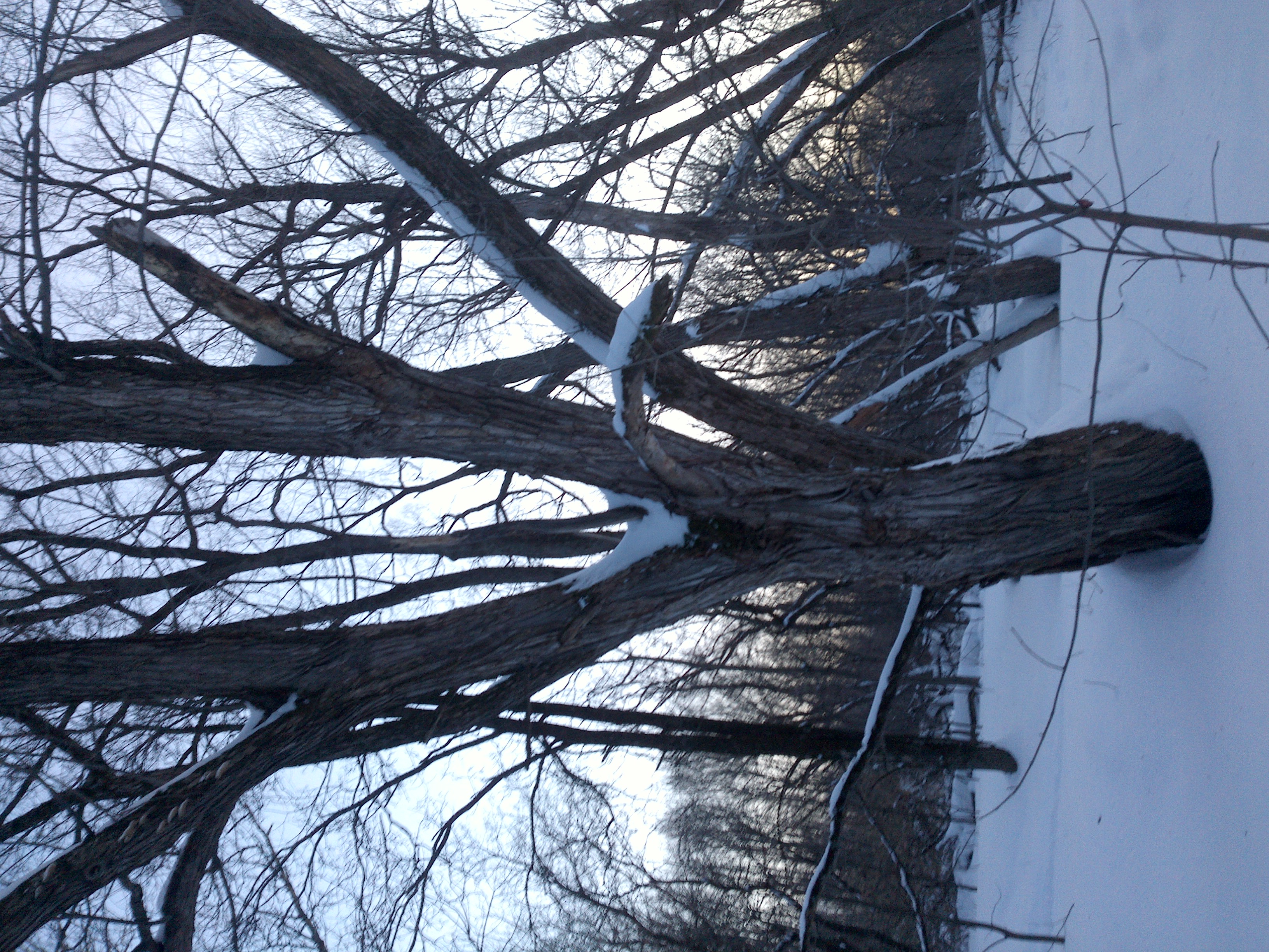
"annotation": "[{\"id\":81,\"image_id\":46,\"category_id\":31,\"segmentation\":[],\"bbox\":[204.25531914893617,318.6382978723404,1683.0638297872338,2557.2765957446813],\"ignore\":0,\"iscrowd\":0,\"area\":4304059.741059303}]",
"format": "json",
"source": "coco"
},
"converted": "{\"key\":\"9e57a955-210620_123936_Garmin_Oregon7xx_DSC00208.jpg\",\"boxes\":[{\"label\":\"Tree\",\"x\":1045.787234042553,\"y\":1597.2765957446811,\"width\":1683.0638297872338,\"height\":2557.2765957446813,\"keypoints\":[]}],\"width\":2448,\"height\":3264}",
"extra": null,
"used": true,
"key": [
"9e57a955-210620_123936_Garmin_Oregon7xx_DSC00208.jpg"
]
},
"trees-qDft": {
"original": {
"annotation": "[{\"id\":81,\"image_id\":46,\"category_id\":31,\"segmentation\":[],\"bbox\":[204.25531914893617,318.6382978723404,1683.0638297872338,2557.2765957446813],\"ignore\":0,\"iscrowd\":0,\"area\":4304059.741059303}]",
"format": "json",
"source": "coco"
},
"extra": null,
"used": true,
"key": [
"9e57a955-210620_123936_Garmin_Oregon7xx_DSC00208.jpg"
],
"by": "vKApOnDiwjaSVG3dsP3mDQx4C3g2",
"converted": "{\"key\":\"9e57a955-210620_123936_Garmin_Oregon7xx_DSC00208.jpg\",\"boxes\":[{\"label\":\"Feuillu\",\"x\":\"1045.79\",\"y\":\"1598.43\",\"width\":\"1683.06\",\"height\":\"2557.28\"}],\"width\":2448,\"height\":3264}",
"lastSet": "1705422708121"
},
"Tree": {
"original": {
"annotation": "[{\"id\":81,\"image_id\":46,\"category_id\":31,\"segmentation\":[],\"bbox\":[204.25531914893617,318.6382978723404,1683.0638297872338,2557.2765957446813],\"ignore\":0,\"iscrowd\":0,\"area\":4304059.741059303}]",
"format": "json",
"source": "coco"
},
"converted": "{\"key\":\"9e57a955-210620_123936_Garmin_Oregon7xx_DSC00208.jpg\",\"boxes\":[{\"label\":\"Tree\",\"x\":1045.787234042553,\"y\":1597.2765957446811,\"width\":1683.0638297872338,\"height\":2557.2765957446813,\"keypoints\":[]}],\"width\":2448,\"height\":3264}",
"extra": null,
"used": true,
"key": [
"9e57a955-210620_123936_Garmin_Oregon7xx_DSC00208.jpg"
]
}
},
"camera": "Garmin Oregon 7xx",
"classes": [
"trees",
"trees-qDft",
"Tree"
],
"created": {
"_seconds": 1705415187,
"_nanoseconds": 336000000
},
"datasets": [
"8Fu4BtpSZNfqPefyaNQh",
"dTeLVe9vEcJB0QKJjjsG",
"FNC1oLpw7yLLJ00srapF"
],
"extension": "jpg",
"hashes": [
"ce4d23ba02838cb6302fbb19eb4023ff"
],
"height": 3264,
"id": "dNDv3JAG0OnWud3AXTRL",
"label": [
"Unlabeled"
],
"metadata": {
"ExifVersion": "0220",
"GPSLatitude": "46,53,21.941983492759192",
"GPSAltitude": "150.39209720802913",
"GPSAltitudeRef": "0",
"DateTime": "2021:06:20 12:39:36",
"GPSMapDatum": "WGS-84",
"DateTimeOriginal": "2021:06:20 12:39:36",
"FlashpixVersion": "0100",
"WhiteBalance": "Auto white balance",
"GPSLatitudeRef": "N",
"GPSVersionID": "2.2.0.0",
"ExifIFDPointer": "124",
"Flash": "Flash did not fire, auto mode",
"FNumber": "2.650000096622392",
"GPSLongitudeRef": "W",
"FocalLengthIn35mmFilm": "31",
"Make": "Garmin",
"GPSLongitude": "71,18,0.3044937547782873",
"Orientation": "right-top",
"GPSImgDirection": "155.8055284793272",
"GPSImgDirectionRef": "T",
"GPSInfoIFDPointer": "290",
"DigitalZoomRatio": "0",
"FocalLength": "4.081999780895211",
"Model": "Oregon 7xx"
},
"name": "9e57a955-210620_123936_Garmin_Oregon7xx_DSC00208.jpg",
"owner": "vKApOnDiwjaSVG3dsP3mDQx4C3g2",
"projects": [
"8Fu4BtpSZNfqPefyaNQh",
"dTeLVe9vEcJB0QKJjjsG",
"FNC1oLpw7yLLJ00srapF"
],
"r": 0.09523809523809523,
"split": "valid",
"split.8Fu4BtpSZNfqPefyaNQh": "valid",
"split.FNC1oLpw7yLLJ00srapF": "valid",
"split.dTeLVe9vEcJB0QKJjjsG": "train",
"tags": [
"8Fu4BtpSZNfqPefyaNQh:status:approved",
"dTeLVe9vEcJB0QKJjjsG:status:annotated",
"FNC1oLpw7yLLJ00srapF:status:approved"
],
"updated": {
"_seconds": 1707833483,
"_nanoseconds": 871000000
},
"updatedDate": "Feb 13, 2024",
"updatedFromRegenerate": "1705422708121",
"updatedTime": "2:11PM",
"updatedTimezone": "+00:00",
"uploader": "vKApOnDiwjaSVG3dsP3mDQx4C3g2",
"width": 2448
}
{
    "boxes": [
        {
            "label": "Tree",
            "x": 1045.787234042553,
            "y": 1597.2765957446811,
            "width": 1683.0638297872338,
            "height": 2557.2765957446813,
            "keypoints": []
        }
    ],
    "height": 3264,
    "key": "9e57a955-210620_123936_Garmin_Oregon7xx_DSC00208.jpg",
    "width": 2448
}
Annotation Editor
Smart Polygon