TRY THIS MODEL
Drop image here to test
tree-detection-ntf74/6 (latest)
The training set is empty.
The validation set is empty.
The testing set is empty.
Classes
Layers
{
"accumulator": null,
"annotation_jobs": [
"8Fu4BtpSZNfqPefyaNQh/uuBTxKKbMKAcfHiSUZpQ",
"FNC1oLpw7yLLJ00srapF/0dMyqFdlywBBMX9BOYxf"
],
"annotations": {
"trees": {
"original": {
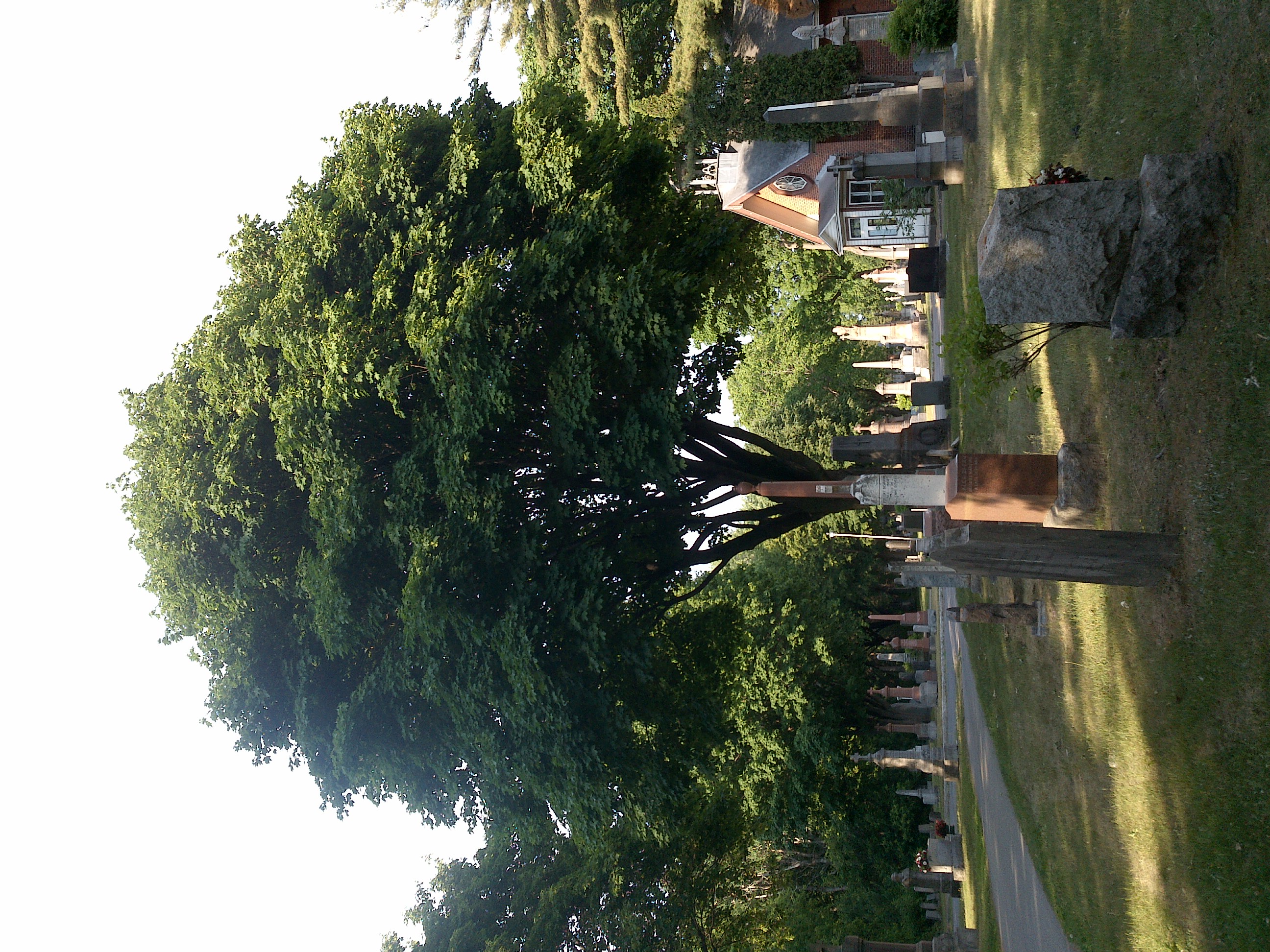
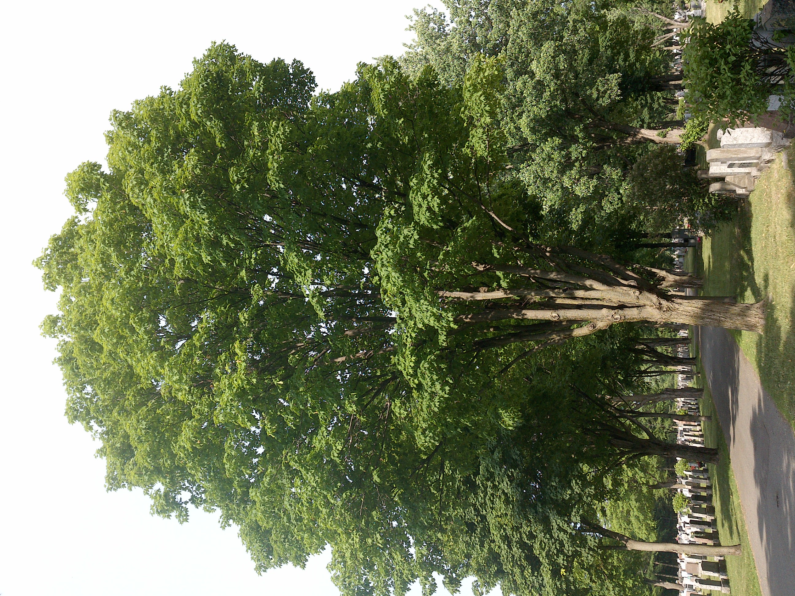
"annotation": "[{\"id\":22,\"image_id\":22,\"category_id\":31,\"segmentation\":[],\"bbox\":[108.8,188.79999999999993,1654.3999999999987,1782.4],\"ignore\":0,\"iscrowd\":0,\"area\":2948802.5599999977},{\"id\":23,\"image_id\":22,\"category_id\":31,\"segmentation\":[],\"bbox\":[1657.6,223.99999999999991,1600.000000000001,1833.6],\"ignore\":0,\"iscrowd\":0,\"area\":2933760.0000000014}]",
"format": "json",
"source": "coco"
},
"converted": "{\"key\":\"f36333d8-200930_165640_Garmin_Oregon7xx_DSC01523.jpg\",\"boxes\":[{\"label\":\"Tree\",\"x\":935.9999999999993,\"y\":1080,\"width\":1654.3999999999987,\"height\":1782.4,\"keypoints\":[]},{\"label\":\"Tree\",\"x\":2457.6000000000004,\"y\":1140.8,\"width\":1600.000000000001,\"height\":1833.6,\"keypoints\":[]}],\"width\":3264,\"height\":2448}",
"extra": null,
"used": true,
"key": [
"f36333d8-200930_165640_Garmin_Oregon7xx_DSC01523.jpg"
]
},
"Tree": {
"original": {
"annotation": "[{\"id\":22,\"image_id\":22,\"category_id\":31,\"segmentation\":[],\"bbox\":[108.8,188.79999999999993,1654.3999999999987,1782.4],\"ignore\":0,\"iscrowd\":0,\"area\":2948802.5599999977},{\"id\":23,\"image_id\":22,\"category_id\":31,\"segmentation\":[],\"bbox\":[1657.6,223.99999999999991,1600.000000000001,1833.6],\"ignore\":0,\"iscrowd\":0,\"area\":2933760.0000000014}]",
"format": "json",
"source": "coco"
},
"extra": null,
"used": true,
"key": [
"f36333d8-200930_165640_Garmin_Oregon7xx_DSC01523.jpg"
],
"by": "vKApOnDiwjaSVG3dsP3mDQx4C3g2",
"converted": "{\"key\":\"f36333d8-200930_165640_Garmin_Oregon7xx_DSC01523.jpg\",\"boxes\":[{\"label\":\"Feuillu automne\",\"x\":\"937.27\",\"y\":\"1080.00\",\"width\":\"1654.40\",\"height\":\"1782.40\"},{\"label\":\"Feuillu automne\",\"x\":\"2457.60\",\"y\":\"1140.80\",\"width\":\"1600.00\",\"height\":\"1833.60\"}],\"width\":3264,\"height\":2448}",
"lastSet": "1708698365573"
}
},
"camera": "Garmin Oregon 7xx",
"classes": [
"trees",
"Tree"
],
"created": {
"_seconds": 1705415496,
"_nanoseconds": 452000000
},
"datasets": [
"8Fu4BtpSZNfqPefyaNQh",
"FNC1oLpw7yLLJ00srapF"
],
"extension": "jpg",
"hashes": [
"96fac649bf8bc0d5f037b1008da08d6f"
],
"height": 2448,
"id": "e96OFZhRZQSiSb3R3XRP",
"label": [
"Unlabeled"
],
"metadata": {
"ExifVersion": "0220",
"GPSLatitude": "46,47,20.78823938147281",
"GPSAltitude": "51.42144433987939",
"GPSAltitudeRef": "0",
"DateTime": "2020:09:30 16:56:40",
"GPSMapDatum": "WGS-84",
"DateTimeOriginal": "2020:09:30 16:56:40",
"FlashpixVersion": "0100",
"WhiteBalance": "Auto white balance",
"GPSLatitudeRef": "N",
"GPSVersionID": "2.2.0.0",
"ExifIFDPointer": "124",
"Flash": "Flash did not fire",
"FNumber": "2.650000096622392",
"GPSLongitudeRef": "W",
"FocalLengthIn35mmFilm": "31",
"Make": "Garmin",
"GPSLongitude": "71,14,40.162852151644636",
"Orientation": "top-left",
"GPSImgDirection": "27.17816553971445",
"GPSImgDirectionRef": "T",
"GPSInfoIFDPointer": "290",
"DigitalZoomRatio": "0",
"FocalLength": "4.081999780895211",
"Model": "Oregon 7xx"
},
"name": "f36333d8-200930_165640_Garmin_Oregon7xx_DSC01523.jpg",
"owner": "vKApOnDiwjaSVG3dsP3mDQx4C3g2",
"projects": [
"8Fu4BtpSZNfqPefyaNQh",
"FNC1oLpw7yLLJ00srapF"
],
"r": 0.14285714285714285,
"split": "train",
"split.8Fu4BtpSZNfqPefyaNQh": "train",
"split.FNC1oLpw7yLLJ00srapF": "test",
"tags": [
"8Fu4BtpSZNfqPefyaNQh:status:approved",
"FNC1oLpw7yLLJ00srapF:status:annotated"
],
"updated": {
"_seconds": 1707833568,
"_nanoseconds": 716000000
},
"updatedDate": "Feb 13, 2024",
"updatedFromRegenerate": "1708698365573",
"updatedTime": "2:12PM",
"updatedTimezone": "+00:00",
"uploader": "vKApOnDiwjaSVG3dsP3mDQx4C3g2",
"width": 3264
}
{
    "boxes": [
        {
            "label": "Tree",
            "x": 935.9999999999993,
            "y": 1080,
            "width": 1654.3999999999987,
            "height": 1782.4,
            "keypoints": []
        },
        {
            "label": "Tree",
            "x": 2457.6000000000004,
            "y": 1140.8,
            "width": 1600.000000000001,
            "height": 1833.6,
            "keypoints": []
        }
    ],
    "height": 2448,
    "key": "f36333d8-200930_165640_Garmin_Oregon7xx_DSC01523.jpg",
    "width": 3264
}
Annotation Editor
Smart Polygon