TRY THIS MODEL
Drop image here to test
tree-detection-by-season-type/4 (latest)
The training set is empty.
The validation set is empty.
The testing set is empty.
Classes
Layers
{
"accumulator": null,
"annotation_jobs": [
"FNC1oLpw7yLLJ00srapF/RH8sBLYdCHkGYsL4Gguo"
],
"annotations": {
"Tree": {
"by": "vKApOnDiwjaSVG3dsP3mDQx4C3g2",
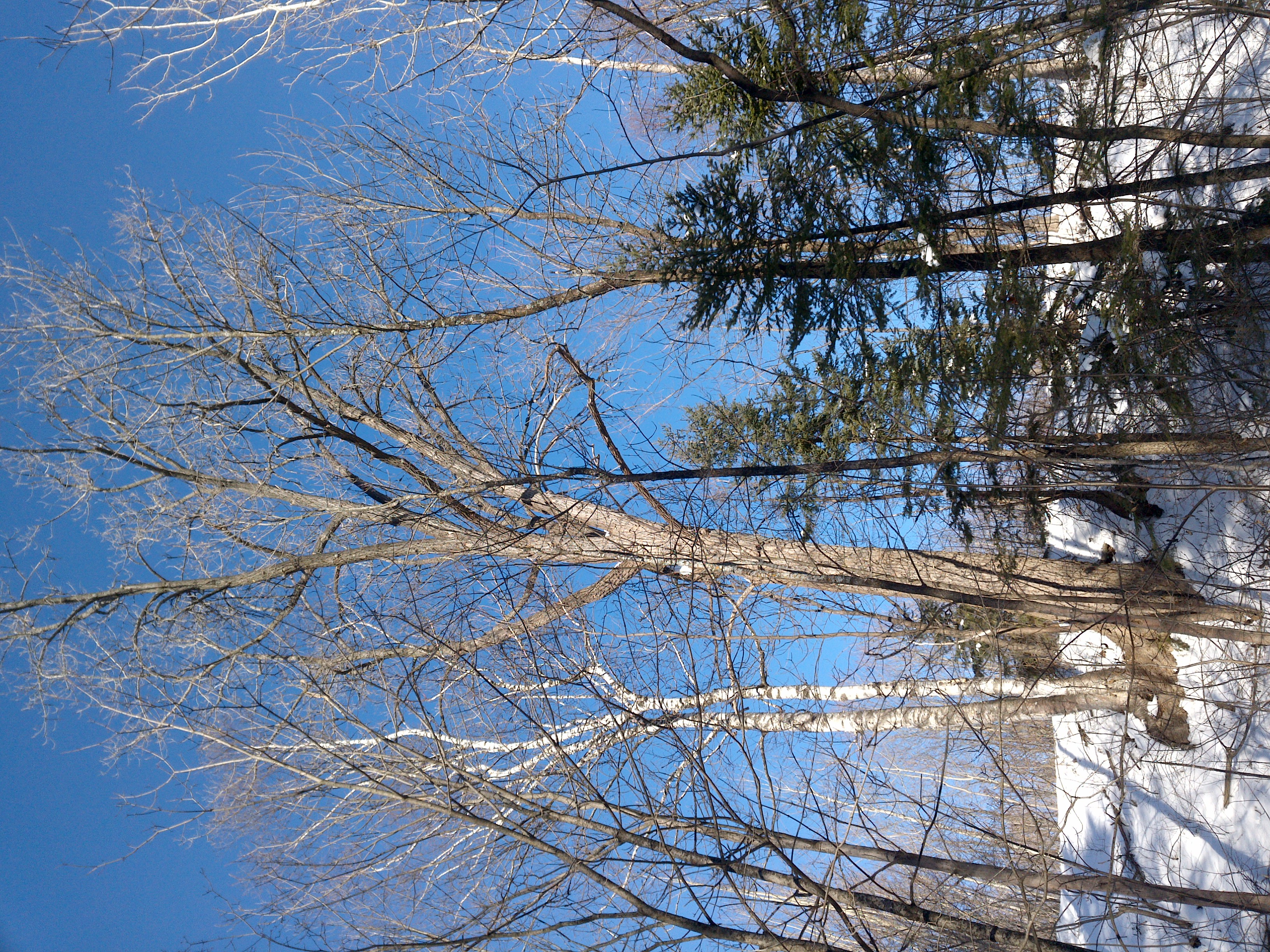
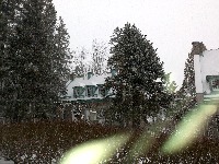
"converted": "{\"key\":\"201228_131253_Garmin_Oregon7xx_DSC02125.jpg\",\"width\":3264,\"height\":2448,\"boxes\":[{\"label\":\"Conifère\",\"x\":\"2063.59\",\"y\":\"1138.16\",\"width\":\"1137.19\",\"height\":\"1646.33\"},{\"label\":\"Conifère\",\"x\":\"546.80\",\"y\":\"890.00\",\"width\":\"1066.41\",\"height\":\"1780.00\"}]}",
"lastSet": "1707835840045"
}
},
"batches": [],
"camera": "Garmin Oregon 7xx",
"created": {
"_seconds": 1707835682,
"_nanoseconds": 624000000
},
"datasets": [
"FNC1oLpw7yLLJ00srapF"
],
"extension": "jpg",
"hashes": [
"8d14fb8fbd35221b1385770727a9a2e8"
],
"height": 2448,
"id": "uwAtCAQfJvzE3suK3SLX",
"label": [
"Unlabeled"
],
"metadata": {
"ExifVersion": "0220",
"GPSLatitude": "46,53,22.421461844713694",
"GPSAltitude": "155.1600817719727",
"GPSAltitudeRef": "0",
"DateTime": "2020:12:28 13:12:53",
"GPSMapDatum": "WGS-84",
"DateTimeOriginal": "2020:12:28 13:12:53",
"FlashpixVersion": "0100",
"WhiteBalance": "Auto white balance",
"GPSLatitudeRef": "N",
"GPSVersionID": "2.2.0.0",
"ExifIFDPointer": "124",
"Flash": "Flash fired, compulsory flash mode",
"FNumber": "2.650000096622392",
"GPSLongitudeRef": "W",
"FocalLengthIn35mmFilm": "31",
"Make": "Garmin",
"GPSLongitude": "71,18,1.076064706087932",
"Orientation": "top-left",
"GPSImgDirection": "12.80838301363704",
"GPSImgDirectionRef": "T",
"GPSInfoIFDPointer": "290",
"DigitalZoomRatio": "0",
"FocalLength": "4.081999780895211",
"Model": "Oregon 7xx"
},
"name": "201228_131253_Garmin_Oregon7xx_DSC02125.jpg",
"owner": "vKApOnDiwjaSVG3dsP3mDQx4C3g2",
"projects": [
"FNC1oLpw7yLLJ00srapF"
],
"r": 0.011363636363636364,
"split": "valid",
"split.FNC1oLpw7yLLJ00srapF": "valid",
"tags": [
"FNC1oLpw7yLLJ00srapF:status:annotated"
],
"updated": {
"_seconds": 1707835682,
"_nanoseconds": 624000000
},
"updatedDate": "Feb 13, 2024",
"updatedFromRegenerate": "1707835840045",
"updatedTime": "2:48PM",
"updatedTimezone": "+00:00",
"uploader": "vKApOnDiwjaSVG3dsP3mDQx4C3g2",
"width": 3264
}
{
    "boxes": [
        {
            "label": "Conifère",
            "x": "2063.59",
            "y": "1138.16",
            "width": "1137.19",
            "height": "1646.33"
        },
        {
            "label": "Conifère",
            "x": "546.80",
            "y": "890.00",
            "width": "1066.41",
            "height": "1780.00"
        }
    ],
    "height": 2448,
    "key": "201228_131253_Garmin_Oregon7xx_DSC02125.jpg",
    "width": 3264
}
Annotation Editor
Smart Polygon