TRY THIS MODEL
Drop image here to test
tree-detection-by-season-type/4 (latest)
The training set is empty.
The validation set is empty.
The testing set is empty.
Classes
Layers
{
"accumulator": null,
"annotation_jobs": [
"8Fu4BtpSZNfqPefyaNQh/qgfW922dieC7zNQJUzhV",
"FNC1oLpw7yLLJ00srapF/cvWua6py6B3jt9D92TgZ"
],
"annotations": {
"trees": {
"original": {
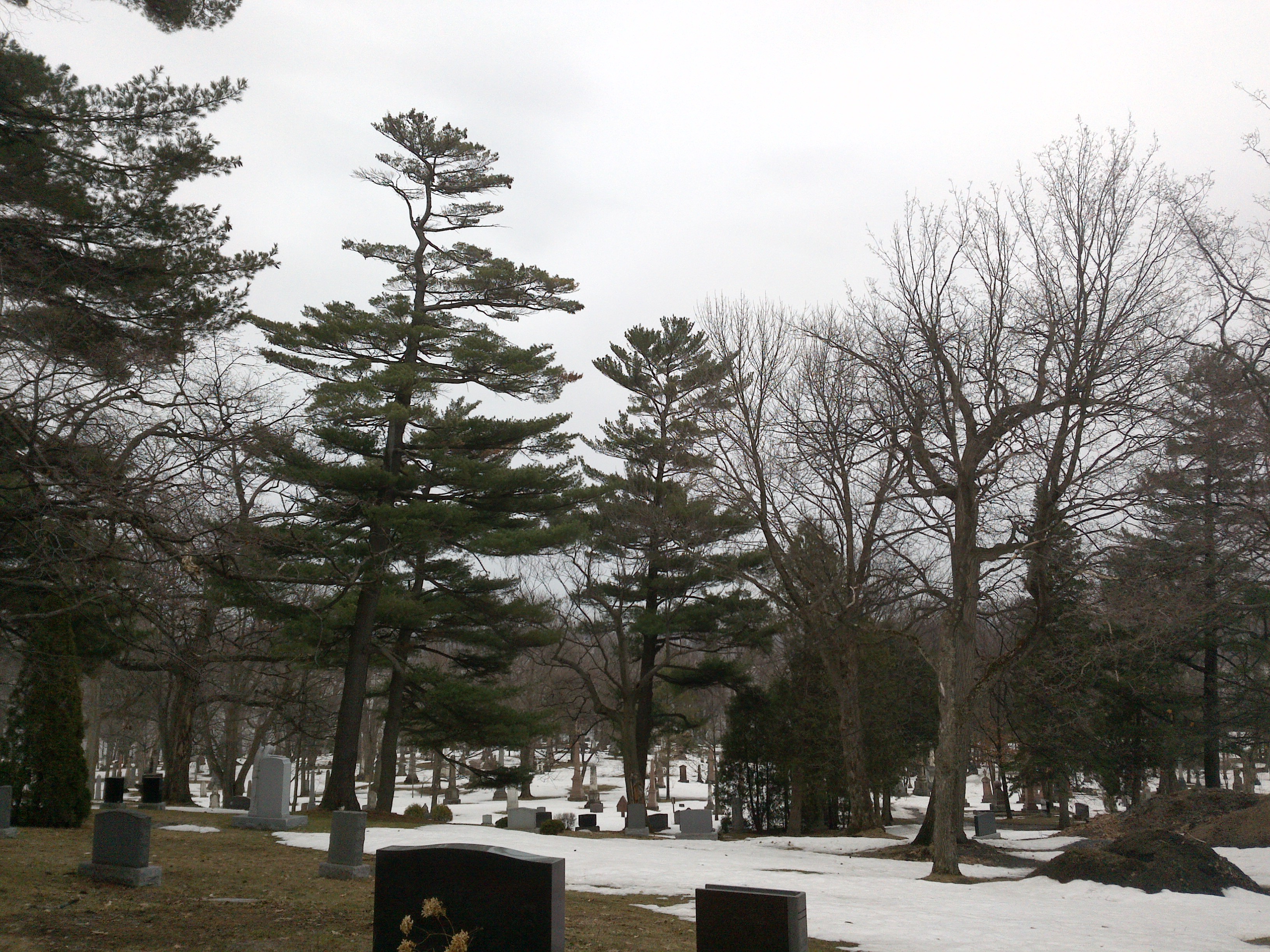
"annotation": "[{\"id\":119,\"image_id\":76,\"category_id\":31,\"segmentation\":[],\"bbox\":[536.7851458885939,290.03713527851454,1017.2944297082232,1792.1774162908341],\"ignore\":0,\"iscrowd\":0,\"area\":1823172.102641541},{\"id\":120,\"image_id\":76,\"category_id\":31,\"segmentation\":[],\"bbox\":[1428.5411140583556,796.5198938992041,593.06100795756,1251.055702917772],\"ignore\":0,\"iscrowd\":0,\"area\":741952.3561834675},{\"id\":121,\"image_id\":76,\"category_id\":31,\"segmentation\":[],\"bbox\":[2034.5888594164458,307.35278514588845,1099.5437665782479,1978.3397899091674],\"ignore\":0,\"iscrowd\":0,\"area\":2175271.1841683453}]",
"format": "json",
"source": "coco"
},
"converted": "{\"key\":\"ac73025a-210324_180146_Garmin_Oregon7xx_DSC02649.jpg\",\"boxes\":[{\"label\":\"Tree\",\"x\":1045.4323607427054,\"y\":1186.1258434239317,\"width\":1017.2944297082232,\"height\":1792.1774162908341,\"keypoints\":[]},{\"label\":\"Tree\",\"x\":1725.0716180371355,\"y\":1422.0477453580902,\"width\":593.06100795756,\"height\":1251.055702917772,\"keypoints\":[]},{\"label\":\"Tree\",\"x\":2584.3607427055695,\"y\":1296.5226801004721,\"width\":1099.5437665782479,\"height\":1978.3397899091674,\"keypoints\":[]}],\"width\":3264,\"height\":2448}",
"extra": null,
"used": true,
"key": [
"ac73025a-210324_180146_Garmin_Oregon7xx_DSC02649.jpg"
]
},
"Tree": {
"original": {
"annotation": "[{\"id\":119,\"image_id\":76,\"category_id\":31,\"segmentation\":[],\"bbox\":[536.7851458885939,290.03713527851454,1017.2944297082232,1792.1774162908341],\"ignore\":0,\"iscrowd\":0,\"area\":1823172.102641541},{\"id\":120,\"image_id\":76,\"category_id\":31,\"segmentation\":[],\"bbox\":[1428.5411140583556,796.5198938992041,593.06100795756,1251.055702917772],\"ignore\":0,\"iscrowd\":0,\"area\":741952.3561834675},{\"id\":121,\"image_id\":76,\"category_id\":31,\"segmentation\":[],\"bbox\":[2034.5888594164458,307.35278514588845,1099.5437665782479,1978.3397899091674],\"ignore\":0,\"iscrowd\":0,\"area\":2175271.1841683453}]",
"format": "json",
"source": "coco"
},
"extra": null,
"used": true,
"key": [
"ac73025a-210324_180146_Garmin_Oregon7xx_DSC02649.jpg"
],
"by": "vKApOnDiwjaSVG3dsP3mDQx4C3g2",
"converted": "{\"key\":\"ac73025a-210324_180146_Garmin_Oregon7xx_DSC02649.jpg\",\"boxes\":[{\"label\":\"Conifère\",\"x\":\"1045.43\",\"y\":\"1187.28\",\"width\":\"1017.29\",\"height\":\"1792.18\"},{\"label\":\"Conifère\",\"x\":\"1725.07\",\"y\":\"1422.05\",\"width\":\"593.06\",\"height\":\"1251.06\"},{\"label\":\"Feuillu hiver\",\"x\":\"2584.36\",\"y\":\"1297.69\",\"width\":\"1099.54\",\"height\":\"1978.34\"}],\"width\":3264,\"height\":2448}",
"lastSet": "1708697445028"
}
},
"camera": "Garmin Oregon 7xx",
"classes": [
"trees",
"Tree"
],
"created": {
"_seconds": 1705415342,
"_nanoseconds": 480000000
},
"datasets": [
"8Fu4BtpSZNfqPefyaNQh",
"FNC1oLpw7yLLJ00srapF"
],
"extension": "jpg",
"hashes": [
"f604bac869b297b985c270944410aa01"
],
"height": 2448,
"id": "qZ3V6P78Tem6UMRma8W4",
"label": [
"Unlabeled"
],
"metadata": {
"ExifVersion": "0220",
"GPSLatitude": "46,46,43.015662407385925",
"GPSAltitude": "59.66044397709688",
"GPSAltitudeRef": "0",
"DateTime": "2021:03:24 18:01:46",
"GPSMapDatum": "WGS-84",
"DateTimeOriginal": "2021:03:24 18:01:46",
"FlashpixVersion": "0100",
"WhiteBalance": "Auto white balance",
"GPSLatitudeRef": "N",
"GPSVersionID": "2.2.0.0",
"ExifIFDPointer": "124",
"Flash": "Flash did not fire",
"FNumber": "2.650000096622392",
"GPSLongitudeRef": "W",
"FocalLengthIn35mmFilm": "31",
"Make": "Garmin",
"GPSLongitude": "71,14,50.81819567456835",
"Orientation": "top-left",
"GPSImgDirection": "95.80654341144648",
"GPSImgDirectionRef": "T",
"GPSInfoIFDPointer": "290",
"DigitalZoomRatio": "0",
"FocalLength": "4.081999780895211",
"Model": "Oregon 7xx"
},
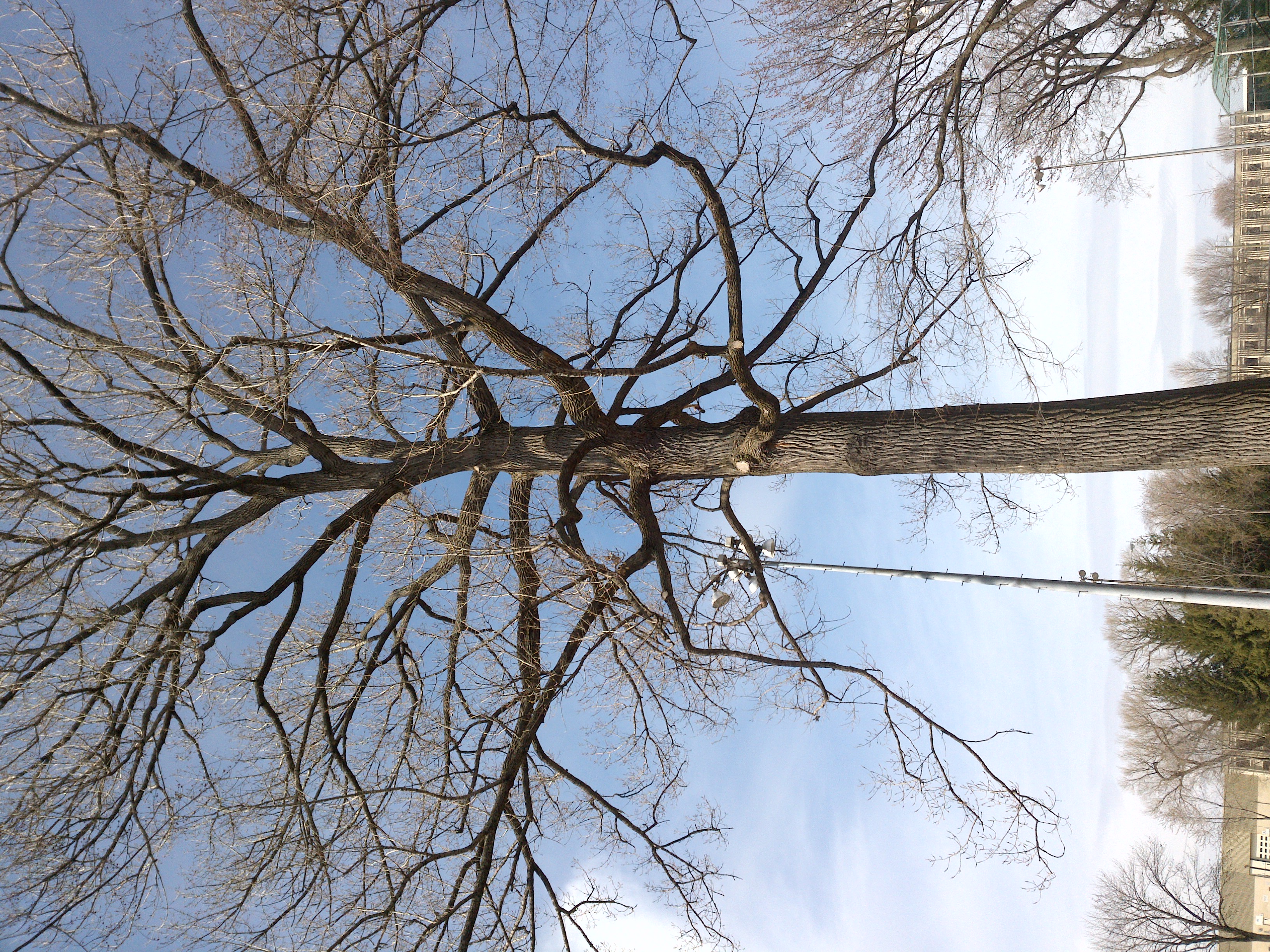
"name": "ac73025a-210324_180146_Garmin_Oregon7xx_DSC02649.jpg",
"owner": "vKApOnDiwjaSVG3dsP3mDQx4C3g2",
"projects": [
"8Fu4BtpSZNfqPefyaNQh",
"FNC1oLpw7yLLJ00srapF"
],
"r": 0.13978494623655913,
"split": "train",
"split.8Fu4BtpSZNfqPefyaNQh": "train",
"split.FNC1oLpw7yLLJ00srapF": "train",
"tags": [
"8Fu4BtpSZNfqPefyaNQh:status:approved",
"FNC1oLpw7yLLJ00srapF:status:annotated"
],
"updated": {
"_seconds": 1707833529,
"_nanoseconds": 14000000
},
"updatedDate": "Feb 13, 2024",
"updatedFromRegenerate": "1708697445028",
"updatedTime": "2:12PM",
"updatedTimezone": "+00:00",
"uploader": "vKApOnDiwjaSVG3dsP3mDQx4C3g2",
"width": 3264
}
{
    "boxes": [
        {
            "label": "Conifère",
            "x": "1045.43",
            "y": "1187.28",
            "width": "1017.29",
            "height": "1792.18"
        },
        {
            "label": "Conifère",
            "x": "1725.07",
            "y": "1422.05",
            "width": "593.06",
            "height": "1251.06"
        },
        {
            "label": "Feuillu hiver",
            "x": "2584.36",
            "y": "1297.69",
            "width": "1099.54",
            "height": "1978.34"
        }
    ],
    "height": 2448,
    "key": "ac73025a-210324_180146_Garmin_Oregon7xx_DSC02649.jpg",
    "width": 3264
}
Annotation Editor
Smart Polygon