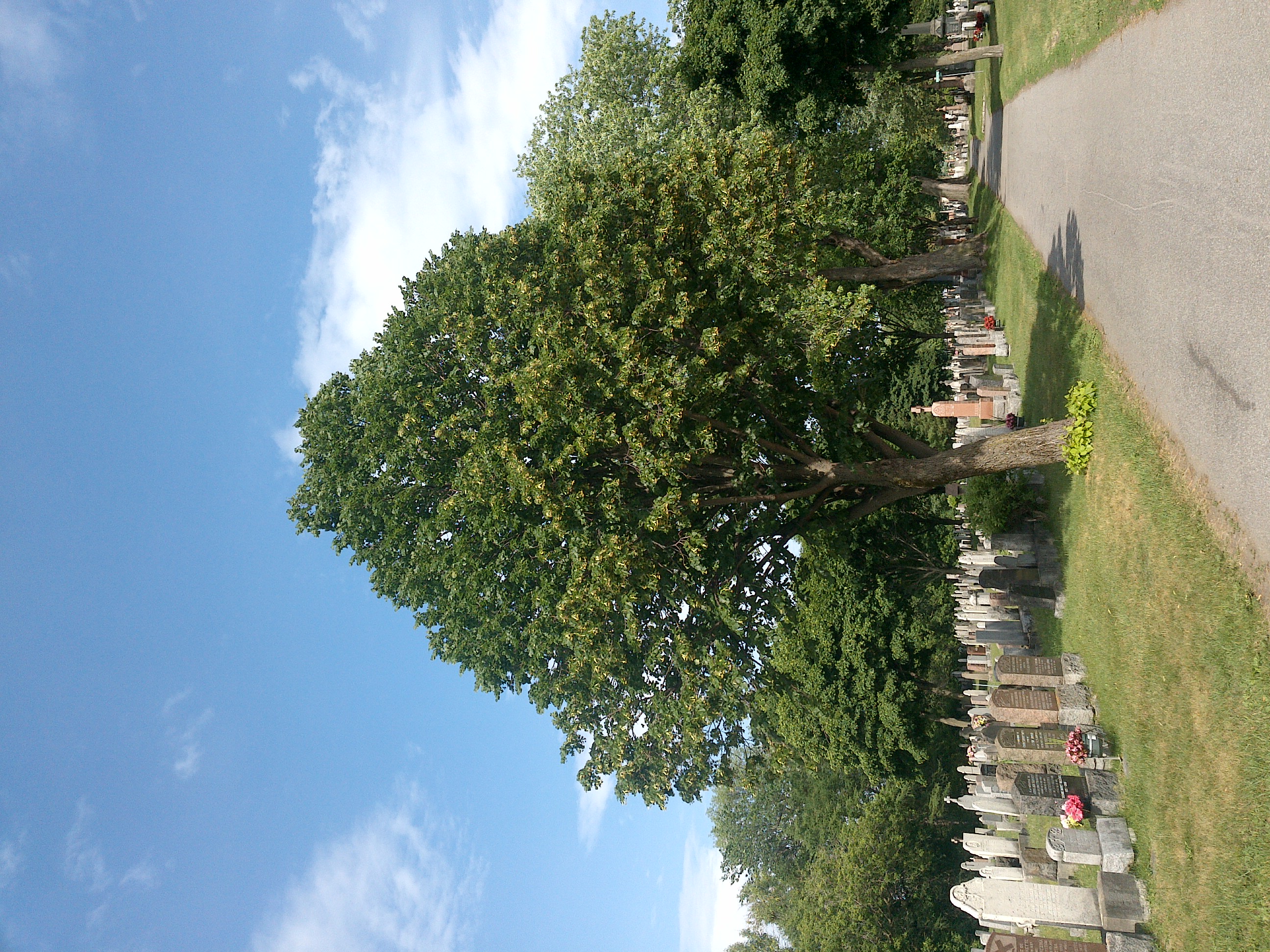
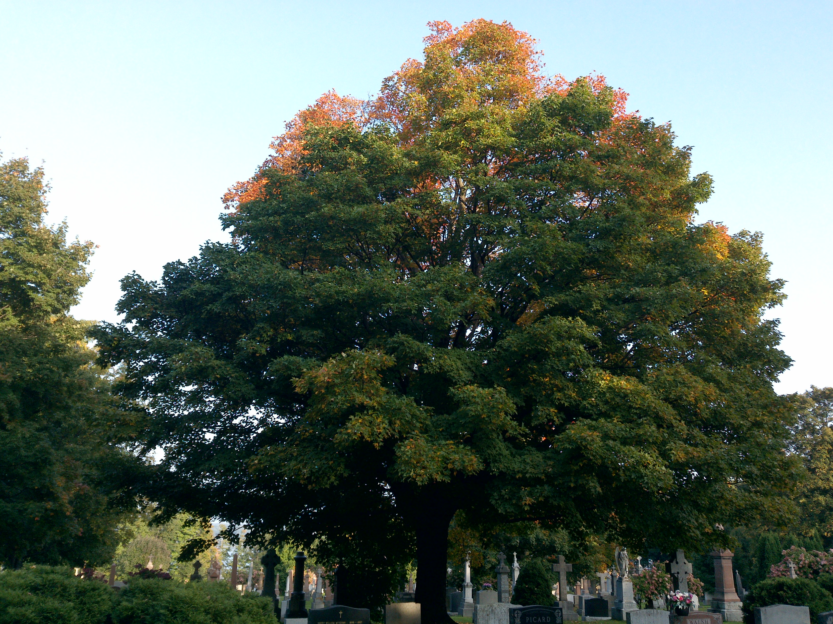
TRY THIS MODEL
Drop image here to test
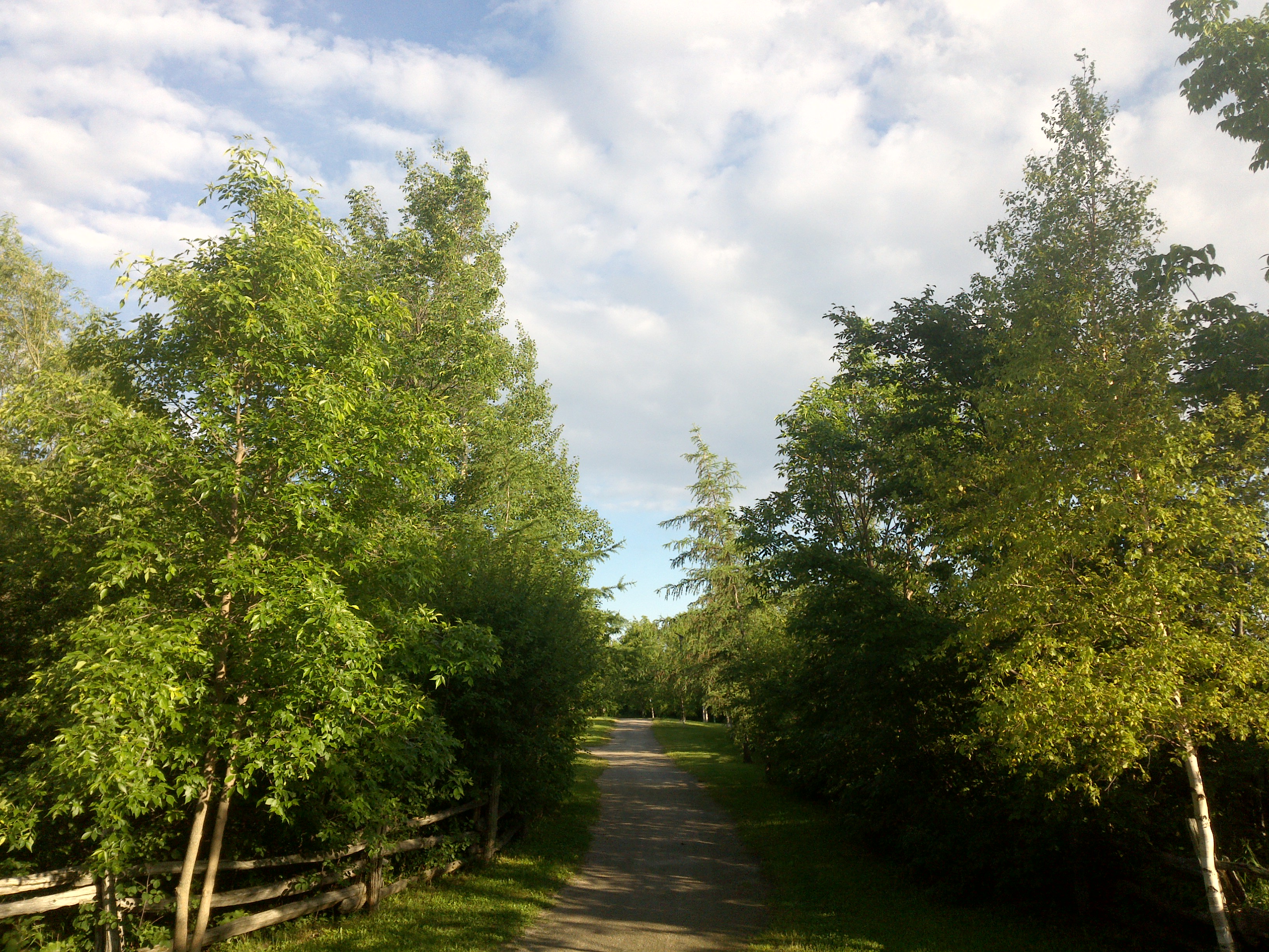
summer-tree-detection/4 (latest)
The training set is empty.
The validation set is empty.
The testing set is empty.
Classes
Layers
                            {
    "accumulator": null,
    "annotation_jobs": [
        "8Fu4BtpSZNfqPefyaNQh/jWRNLH3O7gGpfEWgA3Qx",
        "dTeLVe9vEcJB0QKJjjsG/TuQswcsyxQCCD2IzkL1R",
        "FNC1oLpw7yLLJ00srapF/PlT9prHRuB8Iv4CdDw7J"
    ],
    "annotations": {
        "trees": {
            "original": {
                "annotation": "[{\"id\":20,\"image_id\":10,\"category_id\":31,\"segmentation\":[],\"bbox\":[9.307984790874523,363.01140684410643,1279.8479087452472,2075.680608365019],\"ignore\":0,\"iscrowd\":0,\"area\":2656555.485839032},{\"id\":21,\"image_id\":10,\"category_id\":31,\"segmentation\":[],\"bbox\":[2229.262357414448,670.1749049429658,1033.186311787072,1777.8250950570343],\"ignore\":0,\"iscrowd\":0,\"area\":1836824.5529644783}]",
                "format": "json",
                "source": "coco"
            },
            "converted": "{\"key\":\"9fb9c683-210620_184842_Garmin_Oregon7xx_DSC00240.jpg\",\"boxes\":[{\"label\":\"Tree\",\"x\":649.2319391634982,\"y\":1400.851711026616,\"width\":1279.8479087452472,\"height\":2075.680608365019,\"keypoints\":[]},{\"label\":\"Tree\",\"x\":2745.8555133079844,\"y\":1559.087452471483,\"width\":1033.186311787072,\"height\":1777.8250950570343,\"keypoints\":[]}],\"width\":3264,\"height\":2448}",
            "extra": null,
            "used": true,
            "key": [
                "9fb9c683-210620_184842_Garmin_Oregon7xx_DSC00240.jpg"
            ]
        },
        "trees-qDft": {
            "original": {
                "annotation": "[{\"id\":20,\"image_id\":10,\"category_id\":31,\"segmentation\":[],\"bbox\":[9.307984790874523,363.01140684410643,1279.8479087452472,2075.680608365019],\"ignore\":0,\"iscrowd\":0,\"area\":2656555.485839032},{\"id\":21,\"image_id\":10,\"category_id\":31,\"segmentation\":[],\"bbox\":[2229.262357414448,670.1749049429658,1033.186311787072,1777.8250950570343],\"ignore\":0,\"iscrowd\":0,\"area\":1836824.5529644783}]",
                "format": "json",
                "source": "coco"
            },
            "extra": null,
            "used": true,
            "key": [
                "9fb9c683-210620_184842_Garmin_Oregon7xx_DSC00240.jpg"
            ],
            "by": "vKApOnDiwjaSVG3dsP3mDQx4C3g2",
            "converted": "{\"key\":\"9fb9c683-210620_184842_Garmin_Oregon7xx_DSC00240.jpg\",\"boxes\":[{\"label\":\"Feuillu\",\"x\":\"649.23\",\"y\":\"1400.85\",\"width\":\"1279.85\",\"height\":\"2075.68\"},{\"label\":\"Feuillu\",\"x\":\"2745.86\",\"y\":\"1559.09\",\"width\":\"1033.19\",\"height\":\"1777.83\"},{\"label\":\"Conifère\",\"x\":\"1866.08\",\"y\":\"1483.71\",\"width\":\"432.17\",\"height\":\"807.42\"}],\"width\":3264,\"height\":2448}",
            "lastSet": "1705422824413"
        },
        "Tree": {
            "original": {
                "annotation": "[{\"id\":20,\"image_id\":10,\"category_id\":31,\"segmentation\":[],\"bbox\":[9.307984790874523,363.01140684410643,1279.8479087452472,2075.680608365019],\"ignore\":0,\"iscrowd\":0,\"area\":2656555.485839032},{\"id\":21,\"image_id\":10,\"category_id\":31,\"segmentation\":[],\"bbox\":[2229.262357414448,670.1749049429658,1033.186311787072,1777.8250950570343],\"ignore\":0,\"iscrowd\":0,\"area\":1836824.5529644783}]",
                "format": "json",
                "source": "coco"
            },
            "converted": "{\"key\":\"9fb9c683-210620_184842_Garmin_Oregon7xx_DSC00240.jpg\",\"boxes\":[{\"label\":\"Tree\",\"x\":649.2319391634982,\"y\":1400.851711026616,\"width\":1279.8479087452472,\"height\":2075.680608365019,\"keypoints\":[]},{\"label\":\"Tree\",\"x\":2745.8555133079844,\"y\":1559.087452471483,\"width\":1033.186311787072,\"height\":1777.8250950570343,\"keypoints\":[]}],\"width\":3264,\"height\":2448}",
            "extra": null,
            "used": true,
            "key": [
                "9fb9c683-210620_184842_Garmin_Oregon7xx_DSC00240.jpg"
            ]
        }
    },
    "camera": "Garmin Oregon 7xx",
    "classes": [
        "trees",
        "trees-qDft",
        "Tree"
    ],
    "created": {
        "_seconds": 1705415187,
        "_nanoseconds": 336000000
    },
    "datasets": [
        "8Fu4BtpSZNfqPefyaNQh",
        "dTeLVe9vEcJB0QKJjjsG",
        "FNC1oLpw7yLLJ00srapF"
    ],
    "extension": "jpg",
    "hashes": [
        "d69b9cb0d04404e74c5c6aef609e9bd8"
    ],
    "height": 2448,
    "id": "eE9A9P5HjnHTNYS6JvJS",
    "label": [
        "Unlabeled"
    ],
    "metadata": {
        "ExifVersion": "0220",
        "GPSLatitude": "48,24,3.259783838300363",
        "GPSAltitude": "155.2627156975235",
        "GPSAltitudeRef": "0",
        "DateTime": "2021:06:20 18:48:42",
        "GPSMapDatum": "WGS-84",
        "DateTimeOriginal": "2021:06:20 18:48:42",
        "FlashpixVersion": "0100",
        "WhiteBalance": "Auto white balance",
        "GPSLatitudeRef": "N",
        "GPSVersionID": "2.2.0.0",
        "ExifIFDPointer": "124",
        "Flash": "Flash did not fire, auto mode",
        "FNumber": "2.650000096622392",
        "GPSLongitudeRef": "W",
        "FocalLengthIn35mmFilm": "31",
        "Make": "Garmin",
        "GPSLongitude": "71,46,54.983377918215396",
        "Orientation": "top-left",
        "GPSImgDirection": "122.94880172526966",
        "GPSImgDirectionRef": "T",
        "GPSInfoIFDPointer": "290",
        "DigitalZoomRatio": "0",
        "FocalLength": "4.081999780895211",
        "Model": "Oregon 7xx"
    },
    "name": "9fb9c683-210620_184842_Garmin_Oregon7xx_DSC00240.jpg",
    "owner": "vKApOnDiwjaSVG3dsP3mDQx4C3g2",
    "projects": [
        "8Fu4BtpSZNfqPefyaNQh",
        "dTeLVe9vEcJB0QKJjjsG",
        "FNC1oLpw7yLLJ00srapF"
    ],
    "r": 0.34523809523809523,
    "split": "train",
    "split.8Fu4BtpSZNfqPefyaNQh": "test",
    "split.FNC1oLpw7yLLJ00srapF": "train",
    "split.dTeLVe9vEcJB0QKJjjsG": "train",
    "tags": [
        "8Fu4BtpSZNfqPefyaNQh:status:approved",
        "dTeLVe9vEcJB0QKJjjsG:status:annotated",
        "FNC1oLpw7yLLJ00srapF:status:approved"
    ],
    "updated": {
        "_seconds": 1707833483,
        "_nanoseconds": 871000000
    },
    "updatedDate": "Feb 13, 2024",
    "updatedFromRegenerate": "1705422824413",
    "updatedTime": "2:11PM",
    "updatedTimezone": "+00:00",
    "uploader": "vKApOnDiwjaSVG3dsP3mDQx4C3g2",
    "width": 3264
}
{
    "boxes": [
        {
            "label": "Feuillu",
            "x": "649.23",
            "y": "1400.85",
            "width": "1279.85",
            "height": "2075.68"
        },
        {
            "label": "Feuillu",
            "x": "2745.86",
            "y": "1559.09",
            "width": "1033.19",
            "height": "1777.83"
        },
        {
            "label": "Conifère",
            "x": "1866.08",
            "y": "1483.71",
            "width": "432.17",
            "height": "807.42"
        }
    ],
    "height": 2448,
    "key": "9fb9c683-210620_184842_Garmin_Oregon7xx_DSC00240.jpg",
    "width": 3264
}
Annotation Editor
Smart Polygon