TRY THIS MODEL
Drop image here to test
summer-tree-detection/4 (latest)
The training set is empty.
The validation set is empty.
The testing set is empty.
Classes
Layers
{
"accumulator": null,
"annotation_jobs": [
"8Fu4BtpSZNfqPefyaNQh/jWRNLH3O7gGpfEWgA3Qx",
"dTeLVe9vEcJB0QKJjjsG/TuQswcsyxQCCD2IzkL1R",
"FNC1oLpw7yLLJ00srapF/PlT9prHRuB8Iv4CdDw7J"
],
"annotations": {
"trees": {
"original": {
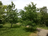
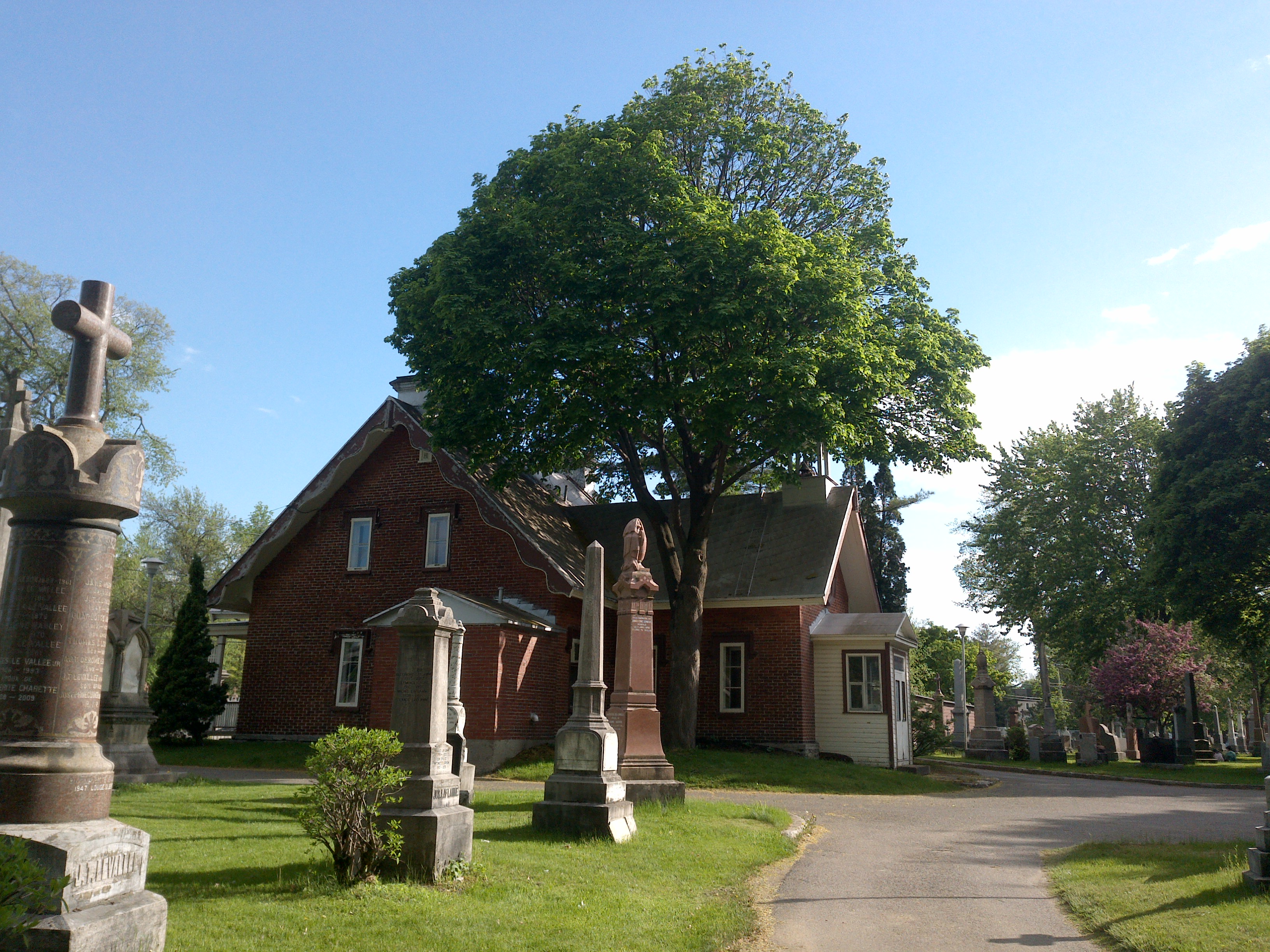
"annotation": "[{\"id\":82,\"image_id\":47,\"category_id\":31,\"segmentation\":[],\"bbox\":[1403.2283805278005,419.74468085106383,661.7872340425535,1326.6382978723402],\"ignore\":0,\"iscrowd\":0,\"area\":877952.2897238572},{\"id\":83,\"image_id\":47,\"category_id\":31,\"segmentation\":[],\"bbox\":[2457.1990387288934,502.46808510638255,805.77968467537,1461.4468085106357],\"ignore\":0,\"iscrowd\":0,\"area\":1177604.1485315259}]",
"format": "json",
"source": "coco"
},
"converted": "{\"key\":\"0a73b255-210620_123956_Garmin_Oregon7xx_DSC00210.jpg\",\"boxes\":[{\"label\":\"Tree\",\"x\":1734.1219975490772,\"y\":1083.063829787234,\"width\":661.7872340425535,\"height\":1326.6382978723402,\"keypoints\":[]},{\"label\":\"Tree\",\"x\":2860.0888810665783,\"y\":1233.1914893617004,\"width\":805.77968467537,\"height\":1461.4468085106357,\"keypoints\":[]}],\"width\":3264,\"height\":2448}",
"extra": null,
"used": true,
"key": [
"0a73b255-210620_123956_Garmin_Oregon7xx_DSC00210.jpg"
]
},
"trees-qDft": {
"original": {
"annotation": "[{\"id\":82,\"image_id\":47,\"category_id\":31,\"segmentation\":[],\"bbox\":[1403.2283805278005,419.74468085106383,661.7872340425535,1326.6382978723402],\"ignore\":0,\"iscrowd\":0,\"area\":877952.2897238572},{\"id\":83,\"image_id\":47,\"category_id\":31,\"segmentation\":[],\"bbox\":[2457.1990387288934,502.46808510638255,805.77968467537,1461.4468085106357],\"ignore\":0,\"iscrowd\":0,\"area\":1177604.1485315259}]",
"format": "json",
"source": "coco"
},
"extra": null,
"used": true,
"key": [
"0a73b255-210620_123956_Garmin_Oregon7xx_DSC00210.jpg"
],
"by": "vKApOnDiwjaSVG3dsP3mDQx4C3g2",
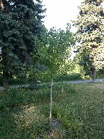
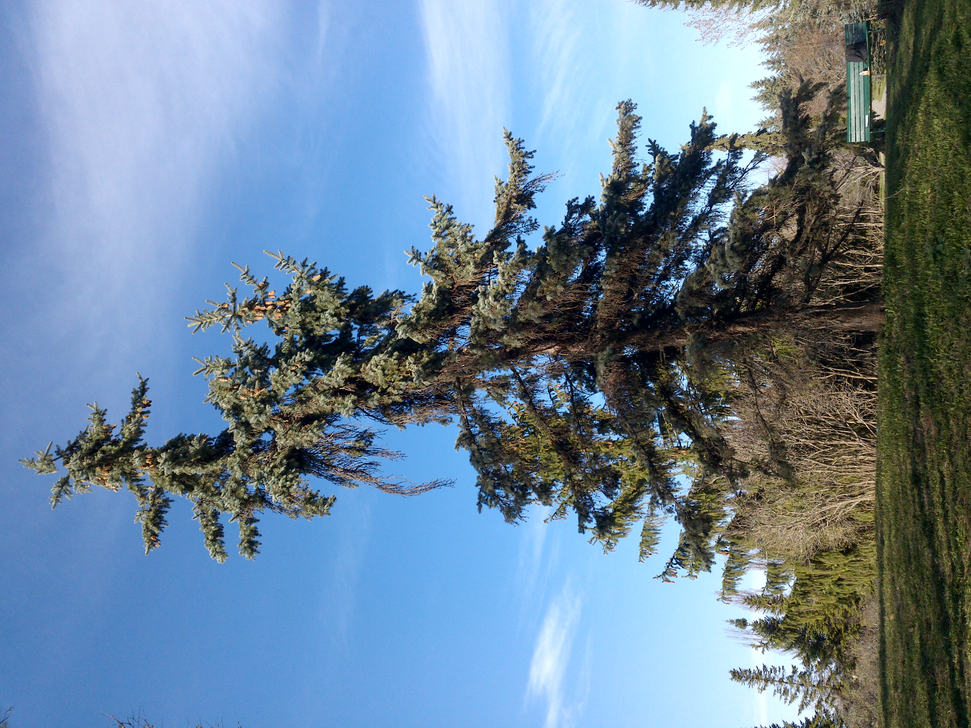
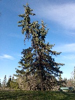
"converted": "{\"key\":\"0a73b255-210620_123956_Garmin_Oregon7xx_DSC00210.jpg\",\"boxes\":[{\"label\":\"Conifère\",\"x\":\"1734.12\",\"y\":\"1083.06\",\"width\":\"661.79\",\"height\":\"1326.64\"},{\"label\":\"Conifère\",\"x\":\"2860.09\",\"y\":\"1233.19\",\"width\":\"805.78\",\"height\":\"1461.45\"},{\"label\":\"Conifère\",\"x\":\"2311.35\",\"y\":\"875.05\",\"width\":\"612.70\",\"height\":\"1299.90\"},{\"label\":\"Feuillu\",\"x\":\"342.50\",\"y\":\"1169.20\",\"width\":\"685.00\",\"height\":\"1381.60\"},{\"label\":\"Feuillu\",\"x\":\"1001.76\",\"y\":\"1331.01\",\"width\":\"587.18\",\"height\":\"763.55\"}],\"width\":3264,\"height\":2448}",
"lastSet": "1705424820609"
},
"Tree": {
"original": {
"annotation": "[{\"id\":82,\"image_id\":47,\"category_id\":31,\"segmentation\":[],\"bbox\":[1403.2283805278005,419.74468085106383,661.7872340425535,1326.6382978723402],\"ignore\":0,\"iscrowd\":0,\"area\":877952.2897238572},{\"id\":83,\"image_id\":47,\"category_id\":31,\"segmentation\":[],\"bbox\":[2457.1990387288934,502.46808510638255,805.77968467537,1461.4468085106357],\"ignore\":0,\"iscrowd\":0,\"area\":1177604.1485315259}]",
"format": "json",
"source": "coco"
},
"extra": null,
"used": true,
"key": [
"0a73b255-210620_123956_Garmin_Oregon7xx_DSC00210.jpg"
],
"by": "vKApOnDiwjaSVG3dsP3mDQx4C3g2",
"converted": "{\"key\":\"0a73b255-210620_123956_Garmin_Oregon7xx_DSC00210.jpg\",\"boxes\":[{\"label\":\"Conifère\",\"x\":\"1734.12\",\"y\":\"1083.06\",\"width\":\"661.79\",\"height\":\"1326.64\"},{\"label\":\"Conifère\",\"x\":\"2860.09\",\"y\":\"1233.19\",\"width\":\"805.78\",\"height\":\"1461.45\"}],\"width\":3264,\"height\":2448}",
"lastSet": "1708571222111"
}
},
"camera": "Garmin Oregon 7xx",
"classes": [
"trees",
"trees-qDft",
"Tree"
],
"created": {
"_seconds": 1705415189,
"_nanoseconds": 766000000
},
"datasets": [
"8Fu4BtpSZNfqPefyaNQh",
"dTeLVe9vEcJB0QKJjjsG",
"FNC1oLpw7yLLJ00srapF"
],
"extension": "jpg",
"hashes": [
"a502e40e3f9ac071d6627cd23fb6e433"
],
"height": 2448,
"id": "8cddoc7K5yR6QywOEQnA",
"label": [
"Unlabeled"
],
"metadata": {
"ExifVersion": "0220",
"GPSLatitude": "46,53,21.956165681802872",
"GPSAltitude": "150.5133892754451",
"GPSAltitudeRef": "0",
"DateTime": "2021:06:20 12:39:56",
"GPSMapDatum": "WGS-84",
"DateTimeOriginal": "2021:06:20 12:39:56",
"FlashpixVersion": "0100",
"WhiteBalance": "Auto white balance",
"GPSLatitudeRef": "N",
"GPSVersionID": "2.2.0.0",
"ExifIFDPointer": "124",
"Flash": "Flash did not fire, auto mode",
"FNumber": "2.650000096622392",
"GPSLongitudeRef": "W",
"FocalLengthIn35mmFilm": "31",
"Make": "Garmin",
"GPSLongitude": "71,18,0.330444127009457",
"Orientation": "top-left",
"GPSImgDirection": "325.53187492932227",
"GPSImgDirectionRef": "T",
"GPSInfoIFDPointer": "290",
"DigitalZoomRatio": "0",
"FocalLength": "4.081999780895211",
"Model": "Oregon 7xx"
},
"name": "0a73b255-210620_123956_Garmin_Oregon7xx_DSC00210.jpg",
"owner": "vKApOnDiwjaSVG3dsP3mDQx4C3g2",
"projects": [
"8Fu4BtpSZNfqPefyaNQh",
"dTeLVe9vEcJB0QKJjjsG",
"FNC1oLpw7yLLJ00srapF"
],
"r": 0.2619047619047619,
"split": "test",
"split.8Fu4BtpSZNfqPefyaNQh": "train",
"split.FNC1oLpw7yLLJ00srapF": "train",
"split.dTeLVe9vEcJB0QKJjjsG": "test",
"tags": [
"8Fu4BtpSZNfqPefyaNQh:status:approved",
"dTeLVe9vEcJB0QKJjjsG:status:annotated",
"FNC1oLpw7yLLJ00srapF:status:annotated"
],
"updated": {
"_seconds": 1707833483,
"_nanoseconds": 871000000
},
"updatedDate": "Feb 13, 2024",
"updatedFromRegenerate": "1708571222111",
"updatedTime": "2:11PM",
"updatedTimezone": "+00:00",
"uploader": "vKApOnDiwjaSVG3dsP3mDQx4C3g2",
"width": 3264
}
{
    "boxes": [
        {
            "label": "Conifère",
            "x": "1734.12",
            "y": "1083.06",
            "width": "661.79",
            "height": "1326.64"
        },
        {
            "label": "Conifère",
            "x": "2860.09",
            "y": "1233.19",
            "width": "805.78",
            "height": "1461.45"
        },
        {
            "label": "Conifère",
            "x": "2311.35",
            "y": "875.05",
            "width": "612.70",
            "height": "1299.90"
        },
        {
            "label": "Feuillu",
            "x": "342.50",
            "y": "1169.20",
            "width": "685.00",
            "height": "1381.60"
        },
        {
            "label": "Feuillu",
            "x": "1001.76",
            "y": "1331.01",
            "width": "587.18",
            "height": "763.55"
        }
    ],
    "height": 2448,
    "key": "0a73b255-210620_123956_Garmin_Oregon7xx_DSC00210.jpg",
    "width": 3264
}
Annotation Editor
Smart Polygon