TRY THIS MODEL
Drop image here to test
waam-70vn2/3 (latest)
The training set is empty.
The validation set is empty.
The testing set is empty.
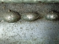
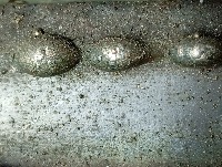
Classes
Layers
{
"accumulator": null,
"annotation_jobs": [
"JMq4Ji7a4cRuHd3Y4gNC/WrPAX2e8lNFQk8KJXiB3"
],
"annotations": {
"Discontinuous": {
"by": "FWtCAoRnNEMWQN9emVF7Uy7jlSm2",
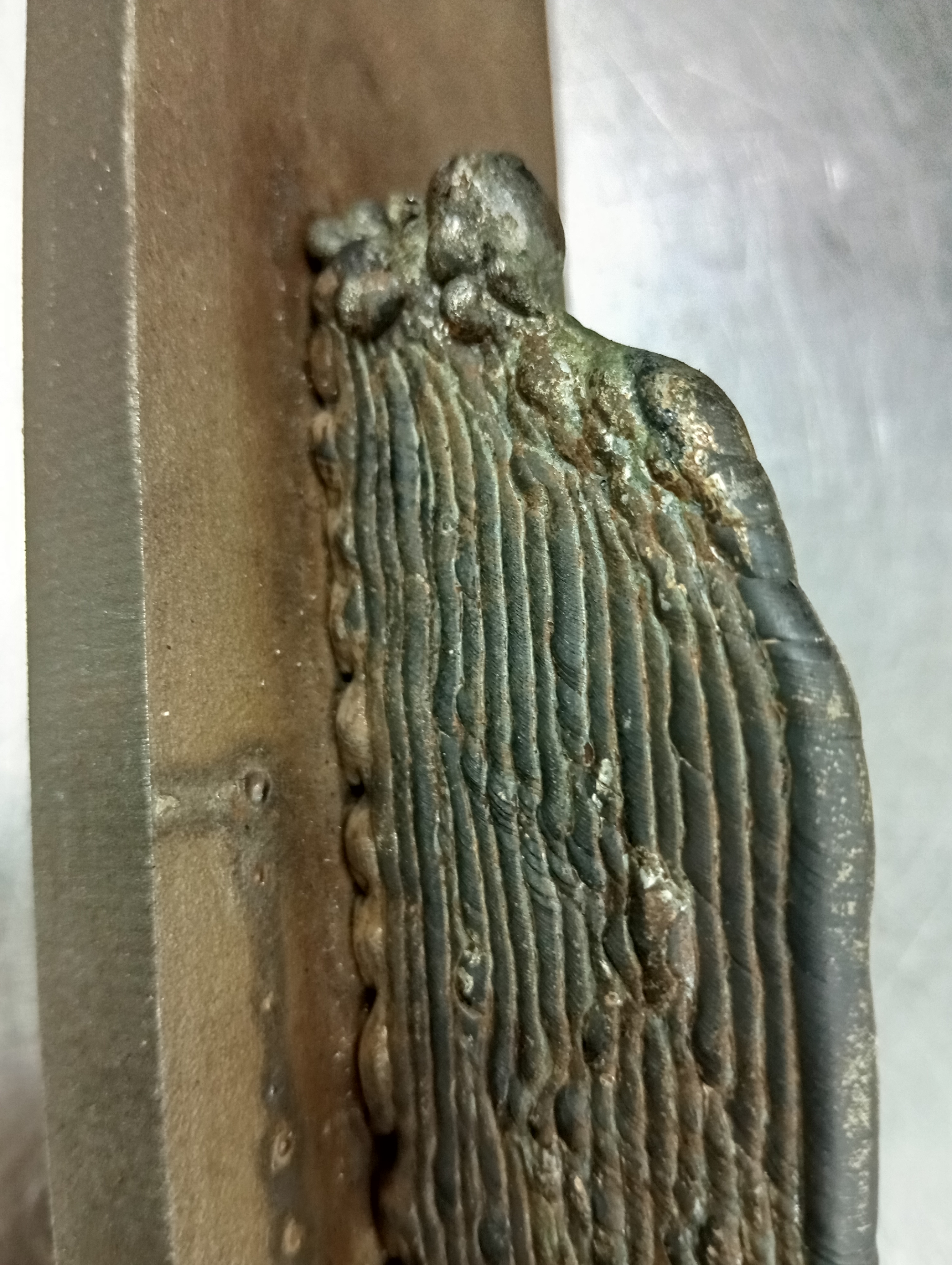
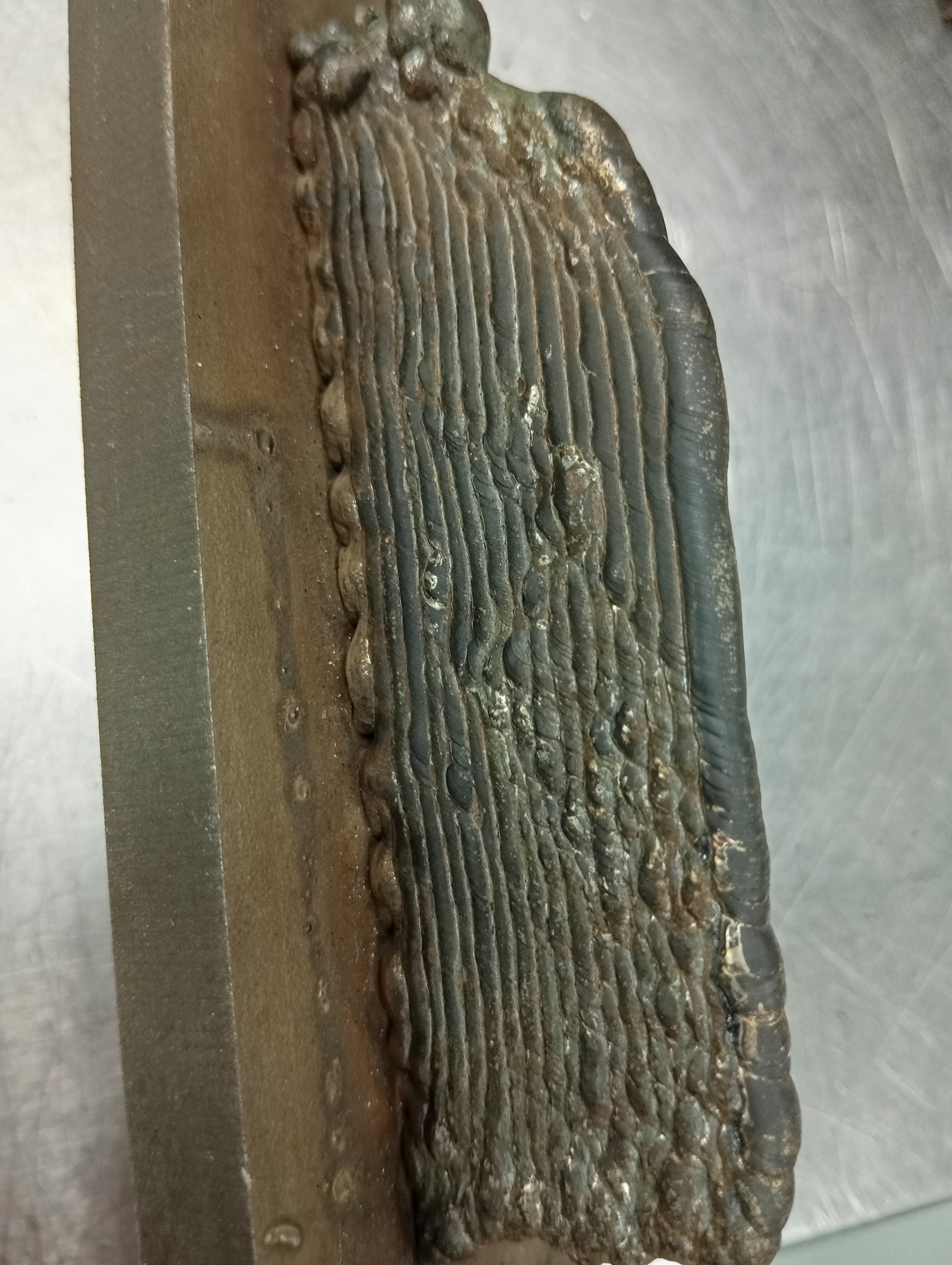
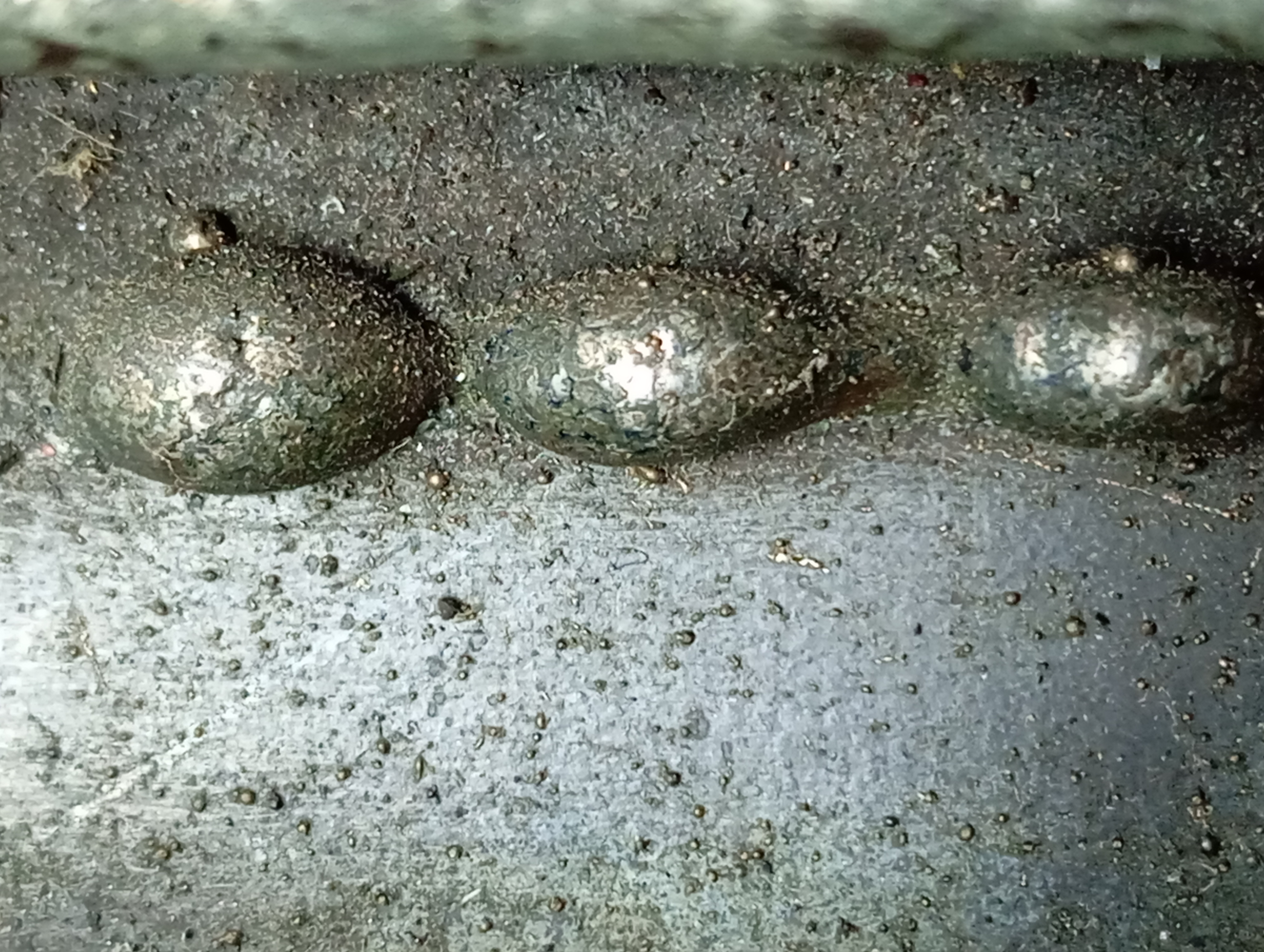
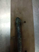
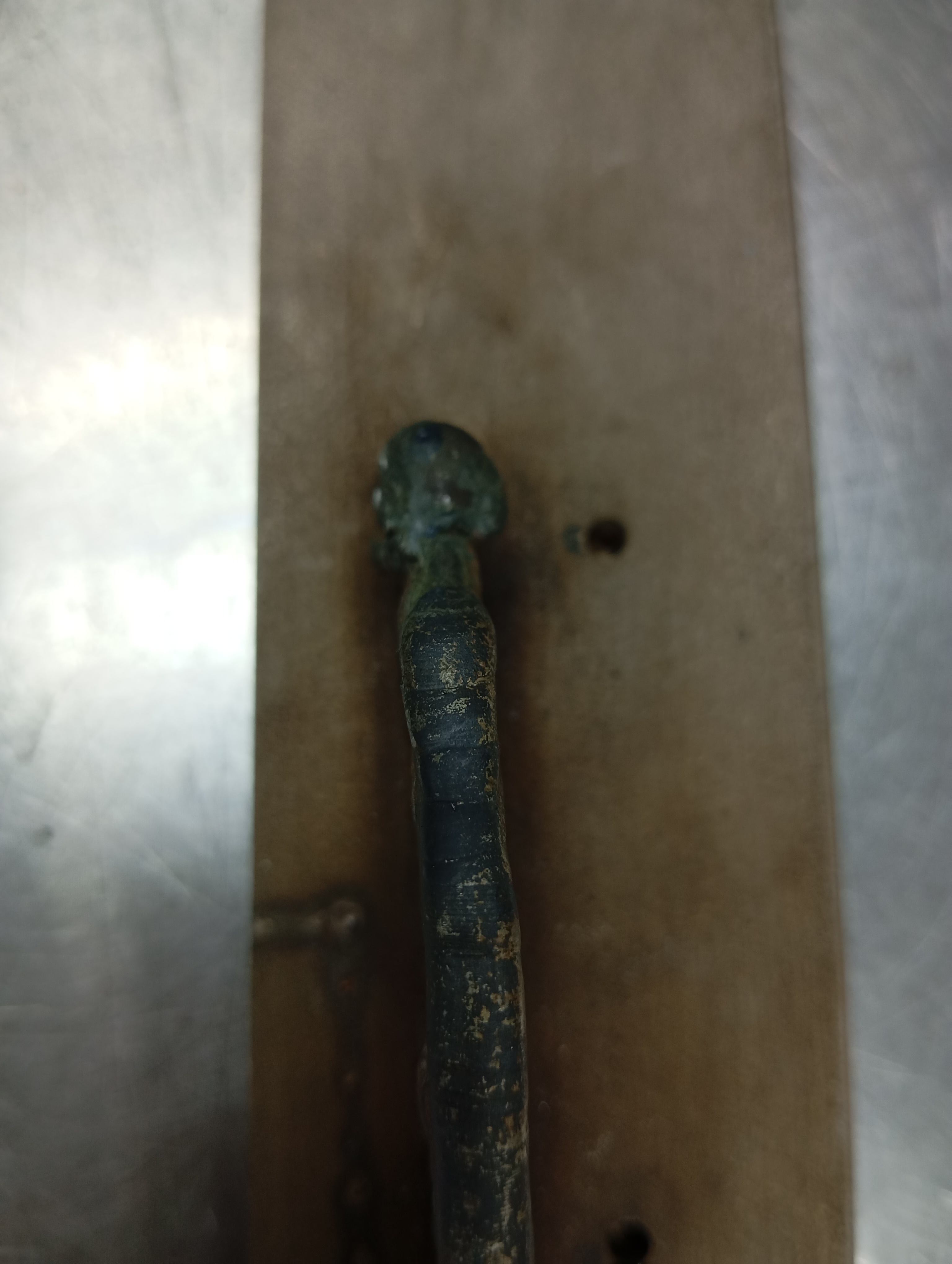
"converted": "{\"key\":\"IMG_20241107_124337.jpg\",\"width\":3072,\"height\":4080,\"boxes\":[{\"id\":\"2\",\"label\":\"Weld\",\"x\":\"1455.00\",\"y\":\"2695.00\",\"width\":\"590.00\",\"height\":\"2770.00\"},{\"id\":\"1\",\"label\":\"Discontinuous\",\"x\":\"1420.00\",\"y\":\"1795.00\",\"width\":\"480.00\",\"height\":\"370.00\"}]}",
"lastSet": "1732678705197"
}
},
"batches": [],
"camera": "Xiaomi 23106RN0DA",
"created": {
"_seconds": 1732250847,
"_nanoseconds": 8000000
},
"datasets": [
"JMq4Ji7a4cRuHd3Y4gNC"
],
"extension": "jpg",
"hashes": [
"b3f4adadeb03298ecb43e9eb825a8dc5"
],
"height": 4080,
"id": "LqkhO2apQMIdfB13ABdk",
"label": [
"Unlabeled"
],
"metadata": {
"ExifVersion": "\u0000\u0002\u0002\u0000",
"GPSLatitude": "2,16,43.77612",
"GPSAltitude": "19.9",
"ExposureProgram": "Undefined",
"GPSAltitudeRef": "0",
"GPSProcessingMethod": "network",
"ColorSpace": "1",
"GPSTimeStamp": "4,43,31",
"BrightnessValue": "0",
"DateTime": "2024:11:07 12:43:37",
"YResolution": "72",
"SubSecTimeOriginal": "997",
"InteroperabilityIFDPointer": "3852",
"GPSSpeed": "0",
"RecommendedExposureIndex": "0",
"ExposureMode": "0",
"GPSSpeedRef": "K",
"ExposureTime": "0.01",
"GPSVersionID": "2.2.0.0",
"ImageWidth": "3072",
"SubSecTime": "997",
"FNumber": "1.8",
"GPSLongitudeRef": "E",
"PixelXDimension": "3072",
"PhotographicSensitivity": "513",
"FocalLengthIn35mmFilm": "28",
"Make": "Xiaomi",
"Orientation": "top-left",
"DateTimeDigitized": "2024:11:07 12:43:37",
"ImageHeight": "4080",
"XResolution": "72",
"FocalLength": "4.22",
"MeteringMode": "CenterWeightedAverage",
"SensitivityType": "0",
"Software": "MediaTek Camera Application",
"ImageDescription": "",
"SceneCaptureType": "Standard",
"MaxApertureValue": "0",
"PixelYDimension": "4080",
"GPSDateStamp": "2024:11:07",
"DateTimeOriginal": "2024:11:07 12:43:37",
"FlashpixVersion": "0100",
"WhiteBalance": "Auto white balance",
"GPSLatitudeRef": "N",
"ExifIFDPointer": "478",
"YCbCrPositioning": "2",
"Flash": "Flash did not fire, compulsory flash mode",
"ComponentsConfiguration": "YCbCr",
"GPSLongitude": "102,16,23.85084",
"SubSecTimeDigitized": "997",
"GPSInfoIFDPointer": "3595",
"DigitalZoomRatio": "1",
"ShutterSpeedValue": "6.643",
"Model": "23106RN0DA",
"ExposureBias": "0",
"ResolutionUnit": "2",
"LightSource": "Other"
},
"name": "IMG_20241107_124337.jpg",
"owner": "FWtCAoRnNEMWQN9emVF7Uy7jlSm2",
"projects": [
"JMq4Ji7a4cRuHd3Y4gNC"
],
"r": 0.8951612903225806,
"split": "train",
"split.JMq4Ji7a4cRuHd3Y4gNC": "train",
"tags": [
"JMq4Ji7a4cRuHd3Y4gNC:status:annotated"
],
"updated": {
"_seconds": 1732250847,
"_nanoseconds": 8000000
},
"updatedDate": "Nov 22, 2024",
"updatedFromRegenerate": "1732678705197",
"updatedTime": "4:47AM",
"updatedTimezone": "+00:00",
"uploader": "FWtCAoRnNEMWQN9emVF7Uy7jlSm2",
"width": 3072
}
{
    "boxes": [
        {
            "id": "2",
            "label": "Weld",
            "x": "1455.00",
            "y": "2695.00",
            "width": "590.00",
            "height": "2770.00"
        },
        {
            "id": "1",
            "label": "Discontinuous",
            "x": "1420.00",
            "y": "1795.00",
            "width": "480.00",
            "height": "370.00"
        }
    ],
    "height": 4080,
    "key": "IMG_20241107_124337.jpg",
    "width": 3072
}
Annotation Editor
Smart Polygon