solar-panel-infrared-images
Annotate
Show/hide annotations(H)
train
Labels
Attributes
Raw Data
Annotations
Group:
defected-solar-panels
Classes
Layers
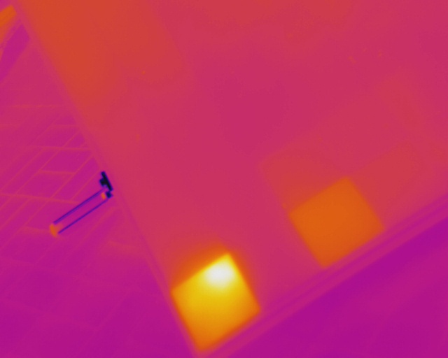
hotspot
1
Unused Classes
diode
Attributes
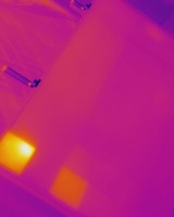
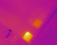
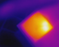
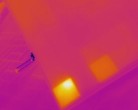
20170710_145200.jpg
640x512
0.33MP
Updated Jun 15, 2022
11:24AM
GMT+00:00
FLIR Vue Pro 640 19mm
𝑓/1.25
Training Set
Annotation History
Loading...
Raw Data
Source Data
                            {
    "accumulator": null,
    "annotation_jobs": [
        "Pjm5OSeWoLH5ebLe3rlY/v7cMsgdC14U7uf5fAjys"
    ],
    "annotations": {
        "defected-solar-panels": {
            "original": {
                "annotation": "0 0.095312 0.810547 0.184375 0.371094\n",
                "format": "txt",
                "source": "YoloDarknet"
            },
            "converted": "{\"key\":\"20170710_145200.jpg\",\"boxes\":[{\"label\":\"hotspot\",\"x\":61,\"y\":415,\"width\":118,\"height\":190}],\"width\":640,\"height\":512}",
            "used": true,
            "key": [
                "20170710_145200.jpg",
                "20170710_145200.jpeg",
                "20170710_145200.png",
                "20170710_145200.bmp"
            ]
        }
    },
    "camera": "FLIR Vue Pro 640 19mm",
    "classes": [
        "defected-solar-panels"
    ],
    "created": {
        "_seconds": 1655292299,
        "_nanoseconds": 994000000
    },
    "datasets": [
        "Pjm5OSeWoLH5ebLe3rlY"
    ],
    "extension": "jpg",
    "hashes": [
        "6e1d3ce6ac783c0dffdf419ad9aad91d"
    ],
    "height": 512,
    "id": "2Rgf5NOnH76fU5M2TI1V",
    "label": [
        "Unlabeled"
    ],
    "metadata": {
        "ExifVersion": "0210",
        "GPSLatitude": "0,0,0",
        "GPSAltitude": "0",
        "GPSAltitudeRef": "0",
        "ColorSpace": "1",
        "GPSTimeStamp": "14,52,0",
        "PixelYDimension": "512",
        "FlashpixVersion": "0100",
        "YResolution": "72",
        "GPSLatitudeRef": "S",
        "GPSSpeed": "0",
        "GPSSpeedRef": "K",
        "SubjectArea": "320,256,640,512",
        "GPSVersionID": "3.2.0.0",
        "GPSTrackRef": "T",
        "ExifIFDPointer": "232",
        "YCbCrPositioning": "1",
        "FNumber": "1.25",
        "GPSLongitudeRef": "W",
        "PixelXDimension": "640",
        "ComponentsConfiguration": "YCbCr",
        "Make": "FLIR",
        "GPSLongitude": "0,0,0",
        "GPSInfoIFDPointer": "1762",
        "XResolution": "72",
        "FocalLength": "19",
        "Model": "Vue Pro 640 19mm",
        "Software": "22.20.16.1",
        "GPSTrack": "0",
        "ResolutionUnit": "2"
    },
    "name": "20170710_145200.jpg",
    "owner": "Tss1aO4rfENgfNQO7ifuiMYUzZa2",
    "projects": [
        "Pjm5OSeWoLH5ebLe3rlY"
    ],
    "r": 0.12773722627737227,
    "split": "train",
    "split.Pjm5OSeWoLH5ebLe3rlY": "train",
    "tags": [
        "Pjm5OSeWoLH5ebLe3rlY:status:approved"
    ],
    "updated": {
        "_seconds": 1655292299,
        "_nanoseconds": 994000000
    },
    "updatedDate": "Jun 15, 2022",
    "updatedTime": "11:24AM",
    "updatedTimezone": "+00:00",
    "uploader": "Tss1aO4rfENgfNQO7ifuiMYUzZa2",
    "width": 640
}
Annotation Data
{
    "boxes": [
        {
            "label": "hotspot",
            "x": 61,
            "y": 415,
            "width": 118,
            "height": 190
        }
    ],
    "height": 512,
    "key": "20170710_145200.jpg",
    "width": 640
}
Annotation Editor
Delete
Save (Enter)
Smart Polygon
Click inside to remove area or outside to expand.
Delete
Finish (Enter)


180%
Reset