TRY THIS MODEL
Drop image here to test
trees-w9wdo/1 (latest)
The training set is empty.
The validation set is empty.
The testing set is empty.
Classes
Layers
{
"accumulator": null,
"annotation_jobs": [
"bLpTnLy2QLiH5uMy7fUE/RpjDl9T36RZiI8jmv2OQ"
],
"annotations": {
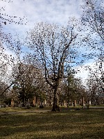
"tree": {
"converted": "{\"key\":\"210417_164059_Garmin_Oregon7xx_DSC02869.jpg\",\"width\":2448,\"height\":3264,\"boxes\":[{\"label\":\"Tree\",\"x\":\"1345.91\",\"y\":\"1502.24\",\"width\":\"1391.82\",\"height\":\"2264.47\"},{\"label\":\"Tree\",\"x\":\"591.67\",\"y\":\"2004.54\",\"width\":\"543.34\",\"height\":\"1070.92\"}]}",
"by": "vKApOnDiwjaSVG3dsP3mDQx4C3g2",
"lastSet": "1707836320105"
}
},
"camera": "Garmin Oregon 7xx",
"classes": [
"tree"
],
"clonedFrom": {
"project": "FNC1oLpw7yLLJ00srapF",
"source": "n5WcYdK1D4jv6YhEXifD"
},
"created": {
"_seconds": 1718373582,
"_nanoseconds": 999000000
},
"datasets": [
"bLpTnLy2QLiH5uMy7fUE"
],
"extension": "jpg",
"hashes": [
"9b841566707753bb46831f667b804c50"
],
"height": 3264,
"id": "KSp0RWAWPUBHyWUmmAfO",
"label": [
"Unlabeled"
],
"metadata": {
"ExifVersion": "0220",
"GPSLatitude": "46,46,48.34574780545217",
"GPSAltitude": "71.0252236550887",
"GPSAltitudeRef": "0",
"DateTime": "2021:04:17 16:40:59",
"GPSMapDatum": "WGS-84",
"DateTimeOriginal": "2021:04:17 16:40:59",
"FlashpixVersion": "0100",
"WhiteBalance": "Auto white balance",
"GPSLatitudeRef": "N",
"GPSVersionID": "2.2.0.0",
"ExifIFDPointer": "124",
"Flash": "Flash did not fire",
"FNumber": "2.650000096622392",
"GPSLongitudeRef": "W",
"FocalLengthIn35mmFilm": "31",
"Make": "Garmin",
"GPSLongitude": "71,14,51.32845253994119",
"Orientation": "right-top",
"GPSImgDirection": "187.0352245532829",
"GPSImgDirectionRef": "T",
"GPSInfoIFDPointer": "290",
"DigitalZoomRatio": "0",
"FocalLength": "4.081999780895211",
"Model": "Oregon 7xx"
},
"name": "210417_164059_Garmin_Oregon7xx_DSC02869.jpg",
"owner": "QM07ThHSYGcpSmm5LTt7",
"projects": [
"bLpTnLy2QLiH5uMy7fUE"
],
"r": 0.1431818181818182,
"split": "train",
"split.bLpTnLy2QLiH5uMy7fUE": "train",
"tags": [
"bLpTnLy2QLiH5uMy7fUE:status:annotated"
],
"updated": {
"_seconds": 1718373582,
"_nanoseconds": 999000000
},
"updatedDate": "Jun 14, 2024",
"updatedFromRegenerate": "1707836320105",
"updatedTime": "1:59PM",
"updatedTimezone": "+00:00",
"uploader": "vKApOnDiwjaSVG3dsP3mDQx4C3g2",
"width": 2448
}
{
    "boxes": [
        {
            "label": "Tree",
            "x": "1345.91",
            "y": "1502.24",
            "width": "1391.82",
            "height": "2264.47"
        },
        {
            "label": "Tree",
            "x": "591.67",
            "y": "2004.54",
            "width": "543.34",
            "height": "1070.92"
        }
    ],
    "height": 3264,
    "key": "210417_164059_Garmin_Oregon7xx_DSC02869.jpg",
    "width": 2448
}
Annotation Editor
Smart Polygon