TRY THIS MODEL
Drop image here to test
imagegeo/2 (latest)
The training set is empty.
The validation set is empty.
The testing set is empty.
CLASSES
LAYERS
{
"accumulator": null,
"annotation_jobs": [
"9S3IF78M7Ul2IfuR5GSI/yKw8vZ2yucsPbIKEAEvS"
],
"annotations": {
"road-": {
"by": "8eA6Oo8frLgZ5FE5gh0qiOIHQTA2",
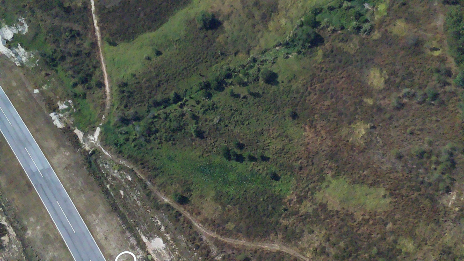
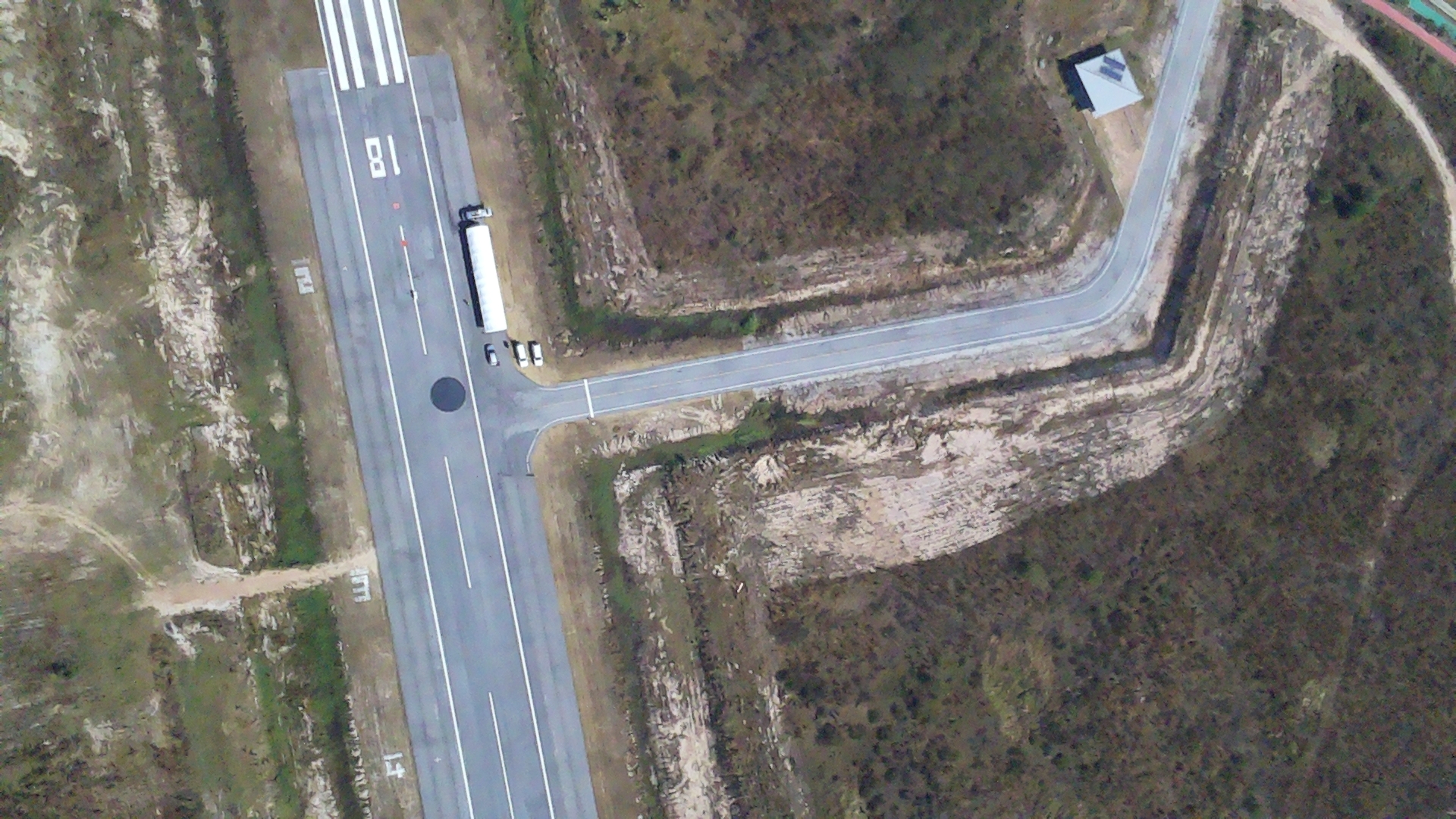
"converted": "{\"key\":\"1705548965_STRIP_IMAGE_NUMBER--40-.jpg\",\"width\":1920,\"height\":1080,\"boxes\":[{\"type\":\"polygon\",\"label\":\"road-\",\"x\":\"1530.0000\",\"y\":\"334.5000\",\"width\":\"780.0000\",\"height\":\"669.0000\",\"points\":[[1140,0],[1145,44],[1186,199],[1223,287],[1244,329],[1278,380],[1319,428],[1377,483],[1463,545],[1541,587],[1597,611],[1716,648],[1808,661],[1920,669],[1920,626],[1822,620],[1755,611],[1682,593],[1619,572],[1562,548],[1510,520],[1398,438],[1326,368],[1271,292],[1237,220],[1217,163],[1176,0]]},{\"type\":\"polygon\",\"label\":\"road-\",\"x\":\"850.0000\",\"y\":\"784.0000\",\"width\":\"328.0000\",\"height\":\"592.0000\",\"points\":[[804,488],[815,491],[823,505],[1014,1080],[905,1080],[873,991],[870,968],[851,916],[845,882],[797,744],[787,729],[766,718],[740,696],[728,674],[686,532],[703,517]]}]}",
"lastSet": "1705679907706"
}
},
"batches": [],
"camera": null,
"created": {
"_seconds": 1705676027,
"_nanoseconds": 830000000
},
"datasets": [
"9S3IF78M7Ul2IfuR5GSI"
],
"extension": "jpg",
"hashes": [
"499c8a705f1bbf7a81f8666a1e6082e7"
],
"height": 1080,
"id": "Ehg5gc48AflwdqoCoyXp",
"label": [
"Unlabeled"
],
"metadata": {
"no": "metadata"
},
"name": "1705548965_STRIP_IMAGE_NUMBER--40-.jpg",
"owner": "0gC606ovQdTlNFe1HGXWUK2lmnA3",
"projects": [
"9S3IF78M7Ul2IfuR5GSI"
],
"r": 0.3389830508474576,
"split": "train",
"split.9S3IF78M7Ul2IfuR5GSI": "train",
"tags": [
"9S3IF78M7Ul2IfuR5GSI:status:annotated"
],
"updated": {
"_seconds": 1705676027,
"_nanoseconds": 830000000
},
"updatedDate": "Jan 19, 2024",
"updatedFromRegenerate": "1705679907706",
"updatedTime": "2:53PM",
"updatedTimezone": "+00:00",
"uploader": "8eA6Oo8frLgZ5FE5gh0qiOIHQTA2",
"width": 1920
}
{
    "boxes": [
        {
            "type": "polygon",
            "label": "road-",
            "x": "1530.0000",
            "y": "334.5000",
            "width": "780.0000",
            "height": "669.0000",
            "points": [
                [
                    1140,
                    0
                ],
                [
                    1145,
                    44
                ],
                [
                    1186,
                    199
                ],
                [
                    1223,
                    287
                ],
                [
                    1244,
                    329
                ],
                [
                    1278,
                    380
                ],
                [
                    1319,
                    428
                ],
                [
                    1377,
                    483
                ],
                [
                    1463,
                    545
                ],
                [
                    1541,
                    587
                ],
                [
                    1597,
                    611
                ],
                [
                    1716,
                    648
                ],
                [
                    1808,
                    661
                ],
                [
                    1920,
                    669
                ],
                [
                    1920,
                    626
                ],
                [
                    1822,
                    620
                ],
                [
                    1755,
                    611
                ],
                [
                    1682,
                    593
                ],
                [
                    1619,
                    572
                ],
                [
                    1562,
                    548
                ],
                [
                    1510,
                    520
                ],
                [
                    1398,
                    438
                ],
                [
                    1326,
                    368
                ],
                [
                    1271,
                    292
                ],
                [
                    1237,
                    220
                ],
                [
                    1217,
                    163
                ],
                [
                    1176,
                    0
                ]
            ]
        },
        {
            "type": "polygon",
            "label": "road-",
            "x": "850.0000",
            "y": "784.0000",
            "width": "328.0000",
            "height": "592.0000",
            "points": [
                [
                    804,
                    488
                ],
                [
                    815,
                    491
                ],
                [
                    823,
                    505
                ],
                [
                    1014,
                    1080
                ],
                [
                    905,
                    1080
                ],
                [
                    873,
                    991
                ],
                [
                    870,
                    968
                ],
                [
                    851,
                    916
                ],
                [
                    845,
                    882
                ],
                [
                    797,
                    744
                ],
                [
                    787,
                    729
                ],
                [
                    766,
                    718
                ],
                [
                    740,
                    696
                ],
                [
                    728,
                    674
                ],
                [
                    686,
                    532
                ],
                [
                    703,
                    517
                ]
            ]
        }
    ],
    "height": 1080,
    "key": "1705548965_STRIP_IMAGE_NUMBER--40-.jpg",
    "width": 1920
}
Annotation Editor
Smart Polygon