TRY THIS MODEL
Drop image here to test
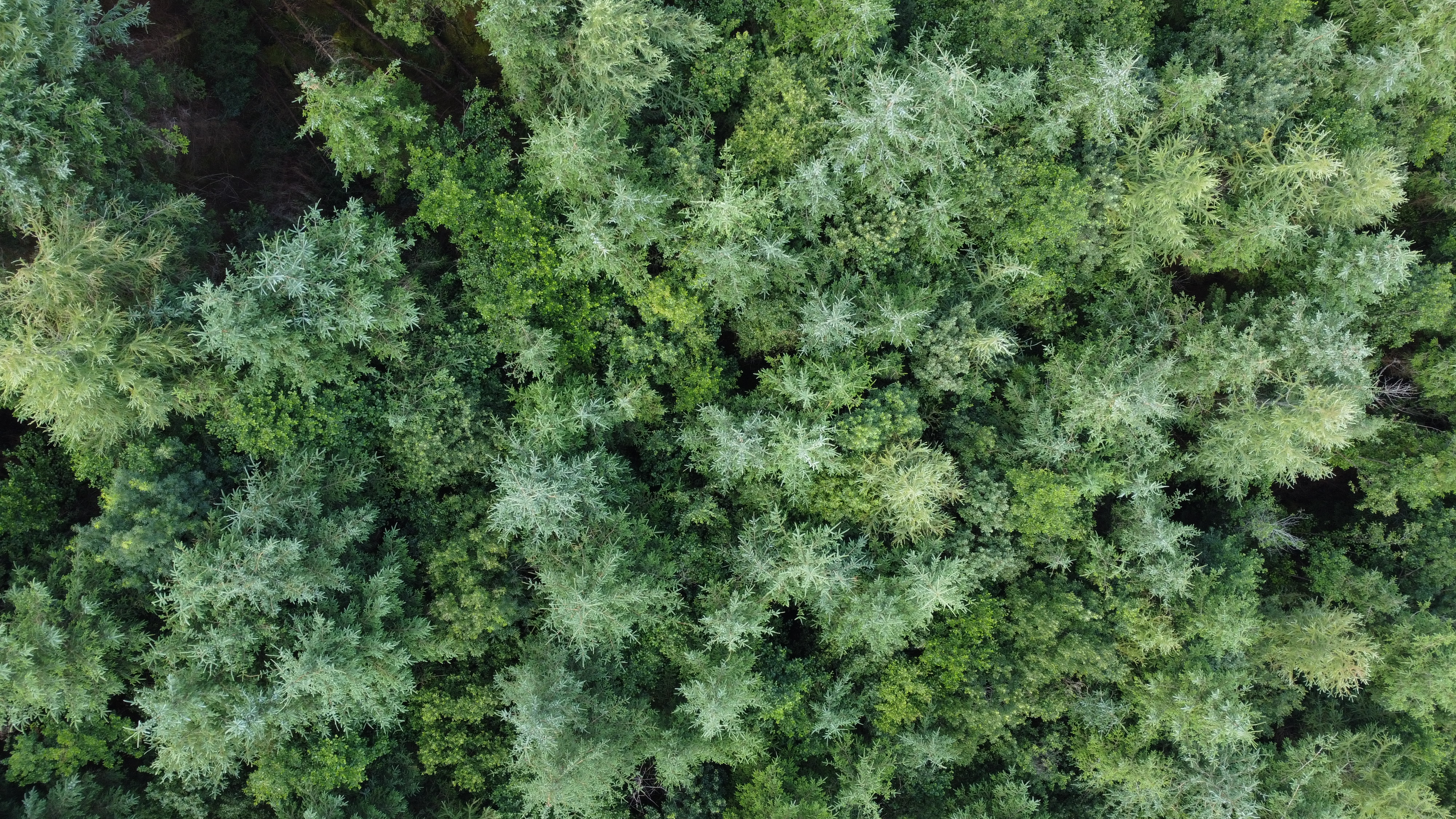
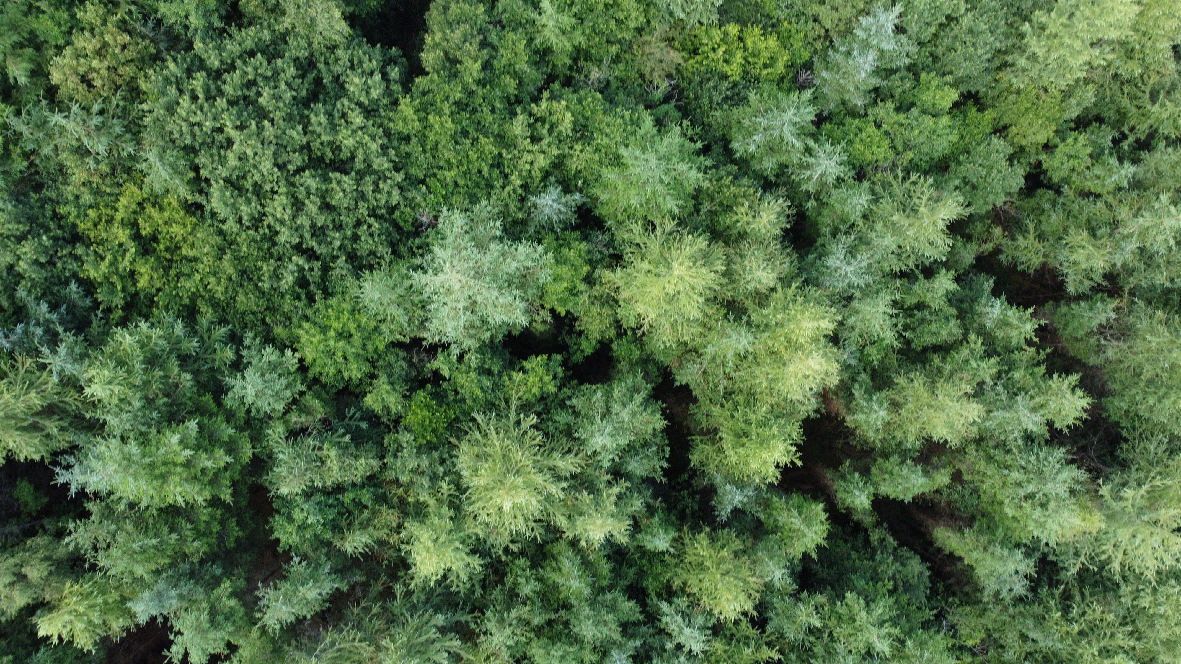
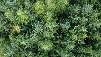
forestry/3 (latest)
The training set is empty.
The validation set is empty.
The testing set is empty.
CLASSES
LAYERS
{
"accumulator": null,
"annotation_jobs": [
"0ayMtWdtevQrXwO26fd8/JJpbijun4XaSXkjIdKZO"
],
"annotations": {
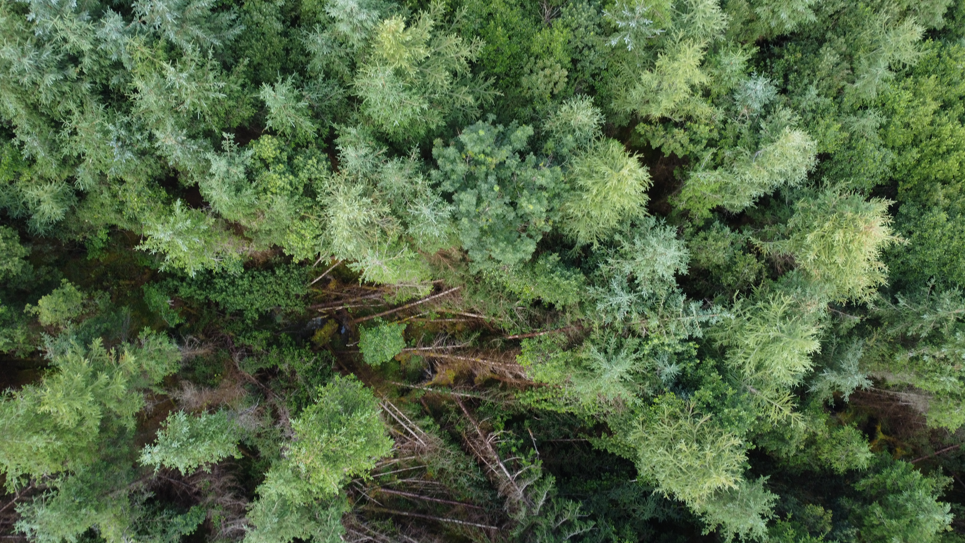
"stems": {
"converted": "{\"key\":\"DJI_0299.JPG\",\"width\":4000,\"height\":2250,\"boxes\":[{\"label\":\"stems\",\"x\":\"2409.87\",\"y\":\"481.27\",\"width\":\"140.52\",\"height\":\"114.76\",\"color\":\"#C7FC00\"},{\"label\":\"stems\",\"x\":\"2565.61\",\"y\":\"738.89\",\"width\":\"175.65\",\"height\":\"175.65\",\"color\":\"#C7FC00\"},{\"label\":\"stems\",\"x\":\"2758.82\",\"y\":\"1073.79\",\"width\":\"163.94\",\"height\":\"142.86\",\"color\":\"#C7FC00\"},{\"label\":\"stems\",\"x\":\"1480.12\",\"y\":\"654.58\",\"width\":\"126.47\",\"height\":\"124.12\",\"color\":\"#C7FC00\"},{\"label\":\"stems\",\"x\":\"1477.77\",\"y\":\"866.52\",\"width\":\"145.20\",\"height\":\"121.78\",\"color\":\"#C7FC00\"},{\"label\":\"stems\",\"x\":\"1656.93\",\"y\":\"730.69\",\"width\":\"100.70\",\"height\":\"126.47\",\"color\":\"#C7FC00\"},{\"label\":\"stems\",\"x\":\"1769.35\",\"y\":\"886.43\",\"width\":\"124.12\",\"height\":\"105.39\",\"color\":\"#C7FC00\"},{\"label\":\"stems\",\"x\":\"1166.29\",\"y\":\"393.45\",\"width\":\"163.94\",\"height\":\"140.52\",\"color\":\"#C7FC00\"},{\"label\":\"stems\",\"x\":\"952.01\",\"y\":\"682.68\",\"width\":\"199.07\",\"height\":\"152.23\",\"color\":\"#C7FC00\"},{\"label\":\"stems\",\"x\":\"3149.93\",\"y\":\"360.66\",\"width\":\"107.73\",\"height\":\"140.52\",\"color\":\"#C7FC00\"},{\"label\":\"stems\",\"x\":\"3071.48\",\"y\":\"240.05\",\"width\":\"138.18\",\"height\":\"124.12\",\"color\":\"#C7FC00\"},{\"label\":\"stems\",\"x\":\"3532.84\",\"y\":\"1556.23\",\"width\":\"189.70\",\"height\":\"170.96\",\"color\":\"#C7FC00\"},{\"label\":\"stems\",\"x\":\"702.59\",\"y\":\"1846.63\",\"width\":\"266.98\",\"height\":\"189.70\",\"color\":\"#C7FC00\"}]}"
}
},
"camera": "DJI FC7303",
"classes": [
"stems"
],
"created": {
"_seconds": 1695152429,
"_nanoseconds": 542000000
},
"datasets": [
"0ayMtWdtevQrXwO26fd8"
],
"extension": "jpg",
"hashes": [
"a70bcbee873fd70a860ede2ce5c433eb"
],
"height": 2250,
"id": "t1JBGVEQy3ACoLtuLJyF",
"label": [
"Unlabeled"
],
"metadata": {
"ApertureValue": "2.97",
"ExifVersion": "0230",
"GPSLatitude": "54,25,4.9902",
"GPSAltitude": "76.272",
"ExposureProgram": "Normal program",
"GPSAltitudeRef": "0",
"ColorSpace": "1",
"DateTime": "2023:07:20 12:46:22",
"YResolution": "72",
"InteroperabilityIFDPointer": "656",
"ExposureMode": "0",
"ExposureTime": "0.008333333333333333",
"GPSVersionID": "2.3.0.0",
"FNumber": "2.8",
"GPSLongitudeRef": "W",
"PixelXDimension": "4000",
"BodySerialNumber": "1SFOHCH0AB0TPV",
"FileSource": "DSC",
"PhotographicSensitivity": "100",
"FocalLengthIn35mmFilm": "24",
"CompressedBitsPerPixel": "3.395952888888889",
"Make": "DJI",
"Orientation": "top-left",
"Contrast": "Normal",
"DateTimeDigitized": "2023:07:20 12:46:22",
"XResolution": "72",
"FocalLength": "4.49",
"MeteringMode": "CenterWeightedAverage",
"GainControl": "None",
"Software": "v01.43.0039",
"ImageDescription": "DCIM\\100MEDIA\\DJI_0299.JPG",
"SceneCaptureType": "Standard",
"SceneType": "Directly photographed",
"SubjectDistanceRange": "Unknown",
"SubjectDistance": "0",
"MaxApertureValue": "2.97",
"PixelYDimension": "2250",
"DateTimeOriginal": "2023:07:20 12:46:22",
"ExposureIndex": "NaN",
"FlashpixVersion": "0100",
"WhiteBalance": "Auto white balance",
"GPSLatitudeRef": "N",
"CustomRendered": "Normal process",
"ExifIFDPointer": "182",
"YCbCrPositioning": "1",
"Flash": "No flash function",
"Saturation": "Normal",
"ComponentsConfiguration": "YCbCr",
"GPSLongitude": "8,9,47.8408",
"Sharpness": "Normal",
"GPSInfoIFDPointer": "686",
"DigitalZoomRatio": "1",
"ShutterSpeedValue": "6.9068",
"Model": "FC7303",
"ExposureBias": "0",
"ResolutionUnit": "2",
"LightSource": "Daylight"
},
"name": "DJI_0299.JPG",
"owner": "hMpdm5g9gxQ3xeCGfbn9A5dzpfg1",
"projects": [
"0ayMtWdtevQrXwO26fd8"
],
"r": 0.5,
"split": "train",
"split.0ayMtWdtevQrXwO26fd8": "train",
"tags": [
"0ayMtWdtevQrXwO26fd8:status:approved"
],
"updated": {
"_seconds": 1695152429,
"_nanoseconds": 542000000
},
"updatedDate": "Sep 19, 2023",
"updatedTime": "7:40PM",
"updatedTimezone": "+00:00",
"uploader": "hMpdm5g9gxQ3xeCGfbn9A5dzpfg1",
"width": 4000
}
{
    "boxes": [
        {
            "label": "stems",
            "x": "2409.87",
            "y": "481.27",
            "width": "140.52",
            "height": "114.76",
            "color": "#C7FC00"
        },
        {
            "label": "stems",
            "x": "2565.61",
            "y": "738.89",
            "width": "175.65",
            "height": "175.65",
            "color": "#C7FC00"
        },
        {
            "label": "stems",
            "x": "2758.82",
            "y": "1073.79",
            "width": "163.94",
            "height": "142.86",
            "color": "#C7FC00"
        },
        {
            "label": "stems",
            "x": "1480.12",
            "y": "654.58",
            "width": "126.47",
            "height": "124.12",
            "color": "#C7FC00"
        },
        {
            "label": "stems",
            "x": "1477.77",
            "y": "866.52",
            "width": "145.20",
            "height": "121.78",
            "color": "#C7FC00"
        },
        {
            "label": "stems",
            "x": "1656.93",
            "y": "730.69",
            "width": "100.70",
            "height": "126.47",
            "color": "#C7FC00"
        },
        {
            "label": "stems",
            "x": "1769.35",
            "y": "886.43",
            "width": "124.12",
            "height": "105.39",
            "color": "#C7FC00"
        },
        {
            "label": "stems",
            "x": "1166.29",
            "y": "393.45",
            "width": "163.94",
            "height": "140.52",
            "color": "#C7FC00"
        },
        {
            "label": "stems",
            "x": "952.01",
            "y": "682.68",
            "width": "199.07",
            "height": "152.23",
            "color": "#C7FC00"
        },
        {
            "label": "stems",
            "x": "3149.93",
            "y": "360.66",
            "width": "107.73",
            "height": "140.52",
            "color": "#C7FC00"
        },
        {
            "label": "stems",
            "x": "3071.48",
            "y": "240.05",
            "width": "138.18",
            "height": "124.12",
            "color": "#C7FC00"
        },
        {
            "label": "stems",
            "x": "3532.84",
            "y": "1556.23",
            "width": "189.70",
            "height": "170.96",
            "color": "#C7FC00"
        },
        {
            "label": "stems",
            "x": "702.59",
            "y": "1846.63",
            "width": "266.98",
            "height": "189.70",
            "color": "#C7FC00"
        }
    ],
    "height": 2250,
    "key": "DJI_0299.JPG",
    "width": 4000
}
Annotation Editor
Smart Polygon