TRY THIS MODEL
Drop image here to test
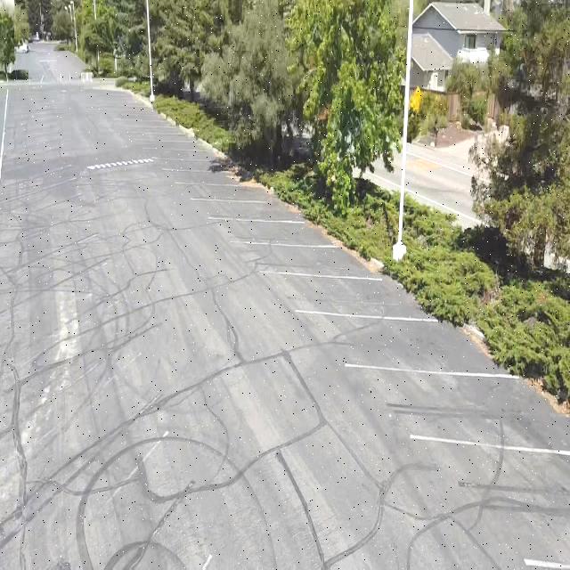
drone-object-detection-yhpn6/23 (latest)
Classes
Layers
| Auto-Orient | Applied |
| Resize | Stretch to 640x640 |
| Brightness | -13% |
| Exposure | 10% |
| Blur | 0.25px |
| Noise | 1.86% |
                            {
    "camera": "Generated by Roboflow",
    "datasets": [
        "tYTuriTOrVKSwKz6zcfG"
    ],
    "destination": "dc27ca24ef57059889e203709b00bf89",
    "height": 640,
    "id": "IZSynj7HeokOvwiGAlo0",
    "label": [],
    "labels": [],
    "name": "2024-01-07-11-12-08-164.PNG",
    "numSteps": 6,
    "owner": "K2ZENWzITGUwmuGZIaGtcGenplH3",
    "preprocessing": [
        "auto-orient",
        "resize:[\"Stretch to\",640,640]",
        "brightness:[-13]",
        "exposure:[10]",
        "blur:[0.25]",
        "noise:[1.86,415317]"
    ],
    "preprocessingParsed": [
        {
            "name": "Auto-Orient",
            "value": "Applied"
        },
        {
            "name": "Resize",
            "value": "Stretch to 640x640"
        },
        {
            "name": "Brightness",
            "value": "-13%"
        },
        {
            "name": "Exposure",
            "value": "10%"
        },
        {
            "name": "Blur",
            "value": "0.25px"
        },
        {
            "name": "Noise",
            "value": "1.86%"
        }
    ],
    "source": "IZSynj7HeokOvwiGAlo0",
    "split": "train",
    "split.tYTuriTOrVKSwKz6zcfG.65": "train",
    "status": "generated",
    "transforms": "[\n    \"auto-orient\",\n    \"resize:[\\\"Stretch to\\\",640,640]\",\n    \"brightness:[-13]\",\n    \"exposure:[10]\",\n    \"blur:[0.25]\",\n    \"noise:[1.86,415317]\"\n]",
    "updated": 1714459193851,
    "updatedDate": "Jan 18, 56299",
    "updatedTime": "4:57PM",
    "updatedTimezone": "+00:00",
    "versions": [
        "tYTuriTOrVKSwKz6zcfG/65"
    ],
    "width": 640
}
{
"boxes": [
{
"type": "polygon",
"label": "Pole",
"x": 253.21433100000002,
"y": 225.589056,
"width": 12.237974000000008,
"height": 451.178112,
"points": [
[
247.095344,
0
],
[
247.761889,
451.178112
],
[
259.333318,
449.185187
],
[
257.093683,
0
],
[
247.095344,
0
]
]
},
{
"type": "polygon",
"label": "Street Sign",
"x": 186.064112,
"y": 298.04534,
"width": 13.413951999999995,
"height": 46.701243999999974,
"points": [
[
192.771088,
274.694718
],
[
179.357136,
276.31746
],
[
180.487405,
321.395962
],
[
192.485404,
317.842603
],
[
192.771088,
274.694718
]
]
},
{
"type": "polygon",
"label": "Street Sign",
"x": 186.486405,
"y": 232.815893,
"width": 34.851348,
"height": 74.62043399999999,
"points": [
[
202.483744,
248.805995
],
[
203.912079,
218.348674
],
[
195.615899,
197.536144
],
[
179.047213,
195.505676
],
[
169.714279,
220.444445
],
[
169.060731,
248.805995
],
[
178.773408,
270.12611
],
[
193.628076,
269.110882
],
[
202.483744,
248.805995
]
]
},
{
"type": "polygon",
"label": "Tree",
"x": 147.8221295,
"y": 239.135391,
"width": 161.473205,
"height": 478.270782,
"points": [
[
67.085527,
0
],
[
81.083219,
41.208052
],
[
89.081883,
59.863204
],
[
94.580962,
74.964919
],
[
98.080366,
88.290001
],
[
102.579627,
114.05184
],
[
104.579302,
128.265247
],
[
106.578978,
140.702004
],
[
110.578291,
240.195956
],
[
116.077409,
321.923132
],
[
131.074918,
478.270782
],
[
155.785708,
460.444445
],
[
148.480868,
408.706959
],
[
139.053853,
306.088712
],
[
136.482847,
280.199989
],
[
137.339856,
248.219777
],
[
133.340516,
225.37678
],
[
134.768851,
176.137425
],
[
138.196844,
142.126755
],
[
143.053193,
122.837097
],
[
143.910181,
104.562707
],
[
145.909862,
74.613
],
[
154.071092,
86.117304
],
[
172.068097,
87.005629
],
[
191.064958,
88.782348
],
[
206.062468,
89.670656
],
[
212.061456,
89.670656
],
[
218.060445,
76.345573
],
[
223.559562,
47.0304
],
[
228.558732,
31.040325
],
[
228.058785,
0
],
[
67.085527,
0
]
]
},
{
"type": "polygon",
"label": "Building",
"x": 450.5474195,
"y": 241.3906185,
"width": 378.905161,
"height": 482.781237,
"points": [
[
490.056801,
0
],
[
460.56169,
12.849989
],
[
261.094839,
110.567249
],
[
261.094839,
311.331821
],
[
265.594062,
312.220147
],
[
267.093828,
196.736102
],
[
327.583777,
195.847778
],
[
327.083867,
355.748762
],
[
357.078888,
363.74379
],
[
381.074919,
354.860403
],
[
378.575333,
416.15586
],
[
640,
482.781237
],
[
640,
0
],
[
490.056801,
0
]
]
},
{
"type": "polygon",
"label": "Building",
"x": 190.81498449999998,
"y": 215.835392,
"width": 108.48197300000001,
"height": 192.76951,
"points": [
[
136.573998,
174.527633
],
[
150.571651,
184.29938
],
[
174.067772,
193.182768
],
[
190.56501,
193.182768
],
[
200.063441,
195.847778
],
[
236.057488,
198.512787
],
[
238.057125,
308.666812
],
[
245.055971,
312.220147
],
[
245.055971,
119.450637
],
[
140.124989,
165.777779
],
[
136.573998,
174.527633
]
]
},
{
"type": "polygon",
"label": "Building",
"x": 57.8370515,
"y": 181.19019949999998,
"width": 99.48348899999999,
"height": 269.166633,
"points": [
[
82.582947,
210.061185
],
[
84.582622,
203.842806
],
[
92.581287,
216.279563
],
[
97.080547,
234.934664
],
[
99.580133,
250.03643
],
[
107.578796,
236.711348
],
[
106.079069,
214.502878
],
[
102.079718,
166.53262
],
[
100.579951,
152.319163
],
[
98.580314,
141.659108
],
[
95.580781,
131.887377
],
[
91.081559,
117.673987
],
[
92.581287,
106.125556
],
[
93.081196,
92.800473
],
[
90.081702,
80.363733
],
[
86.082389,
69.703661
],
[
80.583271,
53.71357
],
[
53.587784,
46.606883
],
[
32.624989,
52.444445
],
[
34.590923,
119.450637
],
[
8.095307,
217.167888
],
[
9.595073,
217.167888
],
[
15.094152,
219.832932
],
[
20.593232,
303.336759
],
[
67.085527,
315.773516
],
[
88.581974,
313.996831
],
[
81.583128,
273.13326
],
[
86.082389,
250.92479
],
[
85.582442,
237.599708
],
[
82.582947,
210.061185
]
]
}
],
"height": 640,
"key": "2024-01-07-11-12-08-164.PNG",
"width": 640
}
Annotation Editor
Smart Polygon


