TRY THIS MODEL
Drop image here to test
aerial-solar-panels/6 (latest)
Updated a year ago
12k
views499
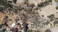
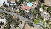
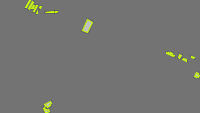
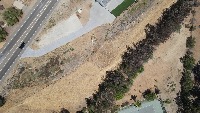
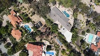
downloadsThis project labels solar panels collected via a DJI Mavic Air 2 flying over Rancho Santa Fe, California in August 2022. Both rooftop and backyard solar panels are labeled. It was used as the basis for the Using Computer Vision with Drones for Georeferencing blog post and the open source DJI aerial georeferencing project.
53 images labeled with 267 polygons were used to train a computer vision model to detect solar panels from above. It's a demonstration of collecting and annotating data from a drone video and using that to train a machine learning model.
Try it in your browser, or deploy via our Hosted Inference API and other deployment methods.
If you use this dataset in a research paper, please cite it using the following BibTeX:
@misc{
aerial-solar-panels_dataset,
title = { Aerial Solar Panels Dataset },
type = { Open Source Dataset },
author = { Brad Dwyer },
howpublished = { \url{ https://universe.roboflow.com/brad-dwyer/aerial-solar-panels } },
url = { https://universe.roboflow.com/brad-dwyer/aerial-solar-panels },
journal = { Roboflow Universe },
publisher = { Roboflow },
year = { 2024 },
month = { feb },
note = { visited on 2025-03-27 },
}