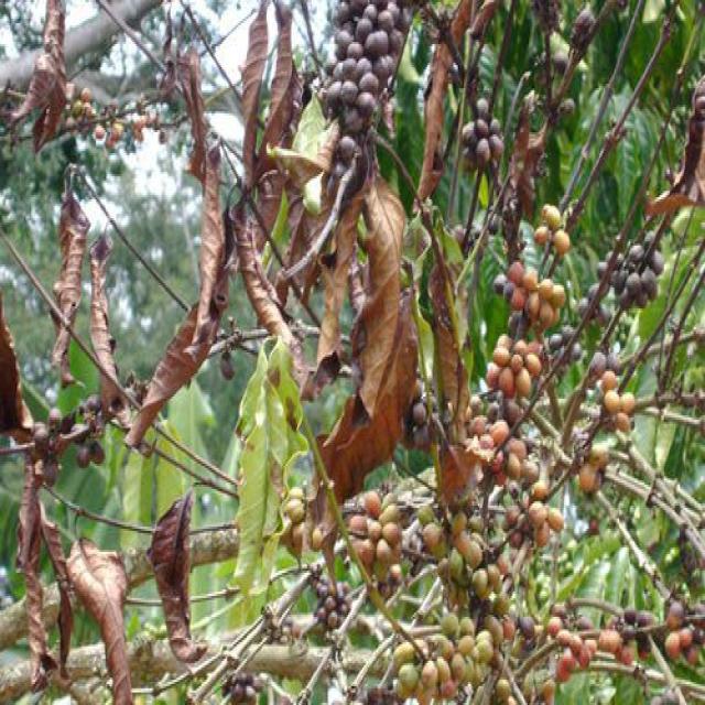
TRY THIS MODEL
Drop image here to test
gwga-detection/11 (latest)
Classes
Layers
| Auto-Orient | Applied |
| Resize | Stretch to 640x640 |
                            {
    "camera": "Generated by Roboflow",
    "datasets": [
        "FH4FJQSv5s6ExnByNTmg"
    ],
    "destination": "b88ce3d4bbcefe7ebc70f55670a45577",
    "height": 640,
    "id": "DPFAfjOy2vzuzsZwP9RI",
    "label": [],
    "labels": [],
    "name": "DJI_0902-.JPG",
    "numSteps": 2,
    "owner": "dbHlLbS5bieuEgJyQje55bR8fNx2",
    "preprocessing": [
        "auto-orient",
        "resize:[\"Stretch to\",640,640]"
    ],
    "preprocessingParsed": [
        {
            "name": "Auto-Orient",
            "value": "Applied"
        },
        {
            "name": "Resize",
            "value": "Stretch to 640x640"
        }
    ],
    "source": "DPFAfjOy2vzuzsZwP9RI",
    "split": "train",
    "split.FH4FJQSv5s6ExnByNTmg.6": "train",
    "status": "generated",
    "transforms": "[\n    \"auto-orient\",\n    \"resize:[\\\"Stretch to\\\",640,640]\"\n]",
    "updated": 1715081022751,
    "updatedDate": "Oct 3, 56318",
    "updatedTime": "7:12PM",
    "updatedTimezone": "+00:00",
    "versions": [
        "FH4FJQSv5s6ExnByNTmg/6"
    ],
    "width": 640
}
{
"boxes": [
{
"type": "polygon",
"label": "yellow",
"x": 572.5,
"y": 574.4444445,
"width": 32.5,
"height": 131.111111,
"points": [
[
588.75,
596.666667
],
[
587.5,
590
],
[
585,
585.555556
],
[
585,
576.666667
],
[
587.5,
572.222222
],
[
587.5,
558.888889
],
[
582.5,
545.555556
],
[
581.25,
532.222222
],
[
570.625,
515.555556
],
[
569.375,
511.111111
],
[
566.875,
508.888889
],
[
559.375,
508.888889
],
[
556.25,
518.888889
],
[
556.25,
527.777778
],
[
558.75,
536.666667
],
[
558.75,
543.333333
],
[
562.5,
554.444444
],
[
562.5,
570
],
[
565,
576.666667
],
[
565,
585.555556
],
[
567.5,
594.444444
],
[
567.5,
614.444444
],
[
573.75,
625.555556
],
[
575,
632.222222
],
[
579.375,
640
],
[
586.25,
638.888889
],
[
587.5,
636.666667
],
[
586.25,
630
],
[
586.25,
605.555556
],
[
588.75,
596.666667
]
]
},
{
"type": "polygon",
"label": "yellow",
"x": 537.5,
"y": 534.4444445,
"width": 25,
"height": 117.77777700000001,
"points": [
[
545,
554.444444
],
[
545,
543.333333
],
[
550,
525.555556
],
[
550,
507.777778
],
[
546.25,
501.111111
],
[
543.75,
485.555556
],
[
538.125,
475.555556
],
[
535.625,
475.555556
],
[
533.75,
481.111111
],
[
533.75,
492.222222
],
[
531.25,
503.333333
],
[
531.25,
530
],
[
528.75,
543.333333
],
[
527.5,
567.777778
],
[
525,
578.888889
],
[
525,
583.333333
],
[
527.5,
590
],
[
529.375,
593.333333
],
[
530,
592.222222
],
[
536.25,
572.222222
],
[
540,
567.777778
],
[
541.25,
561.111111
],
[
545,
554.444444
]
]
},
{
"type": "polygon",
"label": "yellow",
"x": 343.125,
"y": 390,
"width": 43.75,
"height": 64.44444399999998,
"points": [
[
363.125,
360
],
[
360.625,
357.777778
],
[
349.375,
357.777778
],
[
328.75,
378.888889
],
[
321.25,
398.888889
],
[
321.25,
407.777778
],
[
328.125,
422.222222
],
[
331.25,
421.111111
],
[
341.25,
396.666667
],
[
353.125,
375.555556
],
[
365,
363.333333
],
[
363.125,
360
]
]
}
],
"height": 640,
"key": "DJI_0902 .JPG",
"width": 640
}
Annotation Editor
Smart Polygon


