Dataset Versions

v21

2023-05-29 11:31pm

Generated on May 29, 2023

Popular Download Formats

Pascal VOC XML
Common XML annotation format for local data munging (pioneered by ImageNet).
PaliGemma
PaliGemma JSONL format used for fine-tuning PaliGemma, Google's open multimodal vision model.
CreateML JSON
CreateML JSON format is used with Apple's CreateML and Turi Create tools.
Other Formats
Choose another format.

Dataset Split

Train Set 100%
740Images
Valid Set %
0Images
Test Set %
0Images

Preprocessing

Auto-Orient: Applied

Augmentations

No augmentations were applied.

Similar Projects

See More
cse499A
Annotate
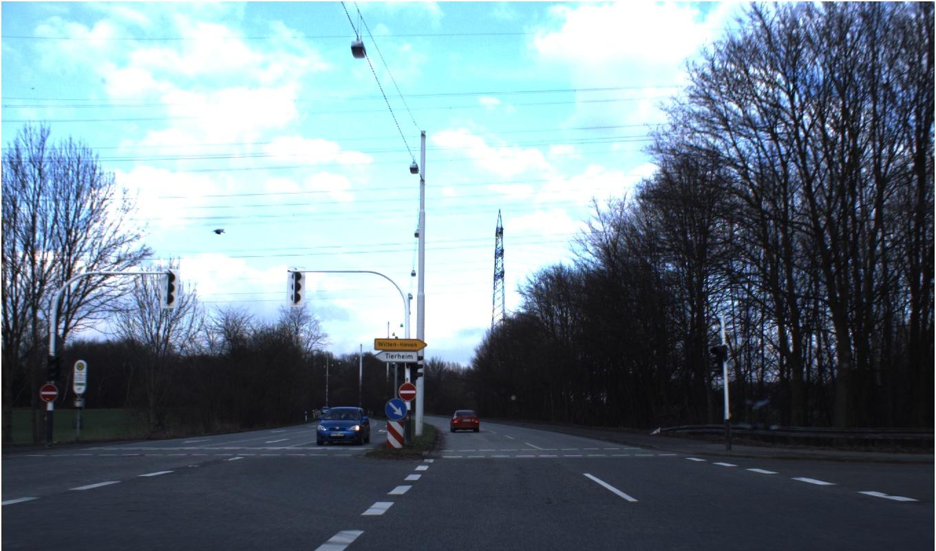
00502.jpg
Show/hide annotations(H)
train
Labels
Attributes
Raw Data

Annotations

Group:
traffic-signs

CLASSES

LAYERS

 
Vehicle entry restricted
2
 
go right lane
1

Unused Classes

Beware of Ice or snow
Crooked road ahead
Cycle movement
Deer movement
End of 80 km speed limit obligations
End of obligations
End of overtaking by lorries
End of overtaking by lorries obligations
End of overtaking obligations
Go Left Lane
Left turn
Maximum speed 100 km
Maximum speed 120 km
Maximum speed 20 km
Maximum speed 30 km
Maximum speed 50 km
Maximum speed 60 km
Maximum speed 70 km
Maximum speed 80 km
NO IDEA
No overtaking
No overtaking by lorries
No way through here
One way road
Other risk possibilities
Parking
Passerby
Passerby crossing
Priority road
Prohibition for all types of vehicle
Right turn
Road is shrinking in the right
Road works
STOP
Slippery road
Small Circle
Sudden turn left
Sudden turn right
Traffic signal
Travel straight or left
Travel straight or right
Truck movement
Uneven road
Zebra-Crossing
let other go first
road in two-side

Tags

No Tags Applied
Type and select tags below to add them to the image.

Attributes

00502.jpg

1360x800
1.09MP

Updated May 29, 2023

5:31PM
GMT+00:00

Generated by Roboflow

Training Set

Transforms

Auto-Orient Applied

Annotation History

Loading...

Raw Data

{
    "camera": "Generated by Roboflow",
    "classes": {
        "Maximum speed 60 km": 30,
        "Zebra-Crossing": 21,
        "No overtaking by lorries": 78,
        "Right turn": 16,
        "road in two-side": 36,
        "Uneven road": 13,
        "Cycle movement": 5,
        "Sudden turn right": 9,
        "Travel straight or left": 2,
        "Small Circle": 11,
        "go right lane": 88,
        "Travel straight or right": 9,
        "Maximum speed 70 km": 67,
        "Vehicle entry restricted": 29,
        "Maximum speed 120 km": 58,
        "Maximum speed 50 km": 80,
        "Passerby crossing": 14,
        "Prohibition for all types of vehicle": 14,
        "Go Left Lane": 6,
        "Other risk possibilities": 35,
        "No way through here": 5,
        "Left turn": 12,
        "Maximum speed 20 km": 4,
        "Sudden turn left": 2,
        "Crooked road ahead": 6,
        "Truck movement": 8,
        "STOP": 31,
        "Maximum speed 30 km": 80,
        "Parking": 9,
        "End of overtaking by lorries": 1,
        "NO IDEA": 1,
        "Maximum speed 100 km": 40,
        "Road works": 30,
        "Passerby": 3,
        "Beware of Ice or snow": 15,
        "let other go first": 80,
        "End of 80 km speed limit obligations": 19,
        "Priority road": 88,
        "One way road": 19,
        "Deer movement": 2,
        "No overtaking": 43,
        "End of obligations": 9,
        "Road is shrinking in the right": 5,
        "Slippery road": 20,
        "Traffic signal": 19,
        "Maximum speed 80 km": 51,
        "End of overtaking by lorries obligations": 10,
        "End of overtaking obligations": 6
    },
    "datasets": [
        "TMD1QKJoxp5vcD7OxzdL"
    ],
    "destination": "b0e0ddaf83c4a334bc2b00429eff0c1d",
    "height": 800,
    "id": "lxjbl2vgEtbDzKMSUh9z",
    "label": [],
    "labels": [],
    "name": "00502.jpg",
    "numSteps": 1,
    "owner": "bVnYttjJ1BZvFGlolCvsKYAb4CG3",
    "preprocessing": [
        "auto-orient"
    ],
    "preprocessingParsed": [
        {
            "name": "Auto-Orient",
            "value": "Applied"
        }
    ],
    "source": "lxjbl2vgEtbDzKMSUh9z",
    "split": "train",
    "split.TMD1QKJoxp5vcD7OxzdL.21": "train",
    "status": "generated",
    "transforms": "[\n    \"auto-orient\"\n]",
    "updated": {
        "_seconds": 1685381469,
        "_nanoseconds": 537000000
    },
    "updatedDate": "May 29, 2023",
    "updatedTime": "5:31PM",
    "updatedTimezone": "+00:00",
    "versions": [
        "TMD1QKJoxp5vcD7OxzdL/21"
    ],
    "width": 1360
}
{
    "boxes": [
        {
            "label": "Vehicle entry restricted",
            "x": 71,
            "y": 570,
            "width": 28,
            "height": 28
        },
        {
            "label": "Vehicle entry restricted",
            "x": 592.5,
            "y": 568.5,
            "width": 27,
            "height": 27
        },
        {
            "label": "go right lane",
            "x": 575,
            "y": 594,
            "width": 34,
            "height": 34
        }
    ],
    "height": 800,
    "key": "00502.jpg",
    "width": 1360
}

Annotation Editor

Delete
Save (Enter)

Smart Polygon

Click inside to remove area or outside to expand.
Undo
Redo
Simplify
Simple Complex
Delete
Finish (Enter)
80%
Reset